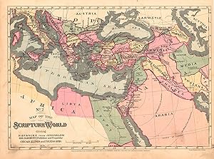
Map of the Scripture World Giving Distances From Jerusalem
H.H. Hardesty & Co.
From
Art Source International Inc., Boulder, CO, U.S.A.
Seller rating 2 out of 5 stars
![]()
AbeBooks Seller since 13 July 2001
About this Item
Description:
These maps intended as references and instructional tools were published in the late 19th century by one of the larger American publishers. They supply good reference for Bible stories and religious education. With bold original outline hand color we see the key areas described in both the Old and New Testaments. This map measures 10 inches by 14 inches. Seller Inventory # 28262
Bibliographic Details
Title: Map of the Scripture World Giving Distances ...
Publication Date: 1881
Top Search Results from the AbeBooks Marketplace
Map of the Scripture World Giving Distances From Jerusalem
Seller: Art Source International Inc., Boulder, CO, U.S.A.
This antique map originally appeared in the "Historical Hand-Atlas" produced in 1882 by H.H. Hardesty & Co. These maps show many details including cities and towns, lakes and rivers, and most important the existing railroad network. This map measures 14 by 10 inches. Seller Inventory # 28448
Quantity: 1 available

