Items related to Geographic information systems, remote sensing and...
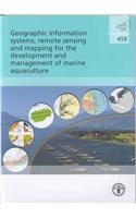
Geographic information systems, remote sensing and mapping for the development and management of marine aquaculture: 458 (FAO fisheries technical paper) - Softcover

The objective of this document is to illustrate the ways in which Geographical Information Systems (GIS), remote sensing and mapping can play a role in the development and management of marine aquaculture. The perspective is global. The approach is to employ example applications that have been aimed at resolving many of the important issues in marine aquaculture. The underlying purpose is to stimulate the interest of individuals in the government, industry and educational sectors of marine aquaculture to make more effective use of these tools. A brief introduction to spatial tools and their use in the marine fisheries sector precedes the example applications. The most recent applications have been selected to be indicative of the state of the art, allowing readers to make their own assessments of the benefits and limitations of use of these tools in their own disciplines.
"synopsis" may belong to another edition of this title.
About the Author:
Food and Agriculture Organization of the United Nations
"About this title" may belong to another edition of this title.
- PublisherFood & Agriculture Organization of the United Nations (FAO)
- Publication date2007
- ISBN 10 9251056463
- ISBN 13 9789251056462
- BindingPaperback
- Number of pages136
(No Available Copies)
Search Books: Create a WantIf you know the book but cannot find it on AbeBooks, we can automatically search for it on your behalf as new inventory is added. If it is added to AbeBooks by one of our member booksellers, we will notify you!
Create a Want