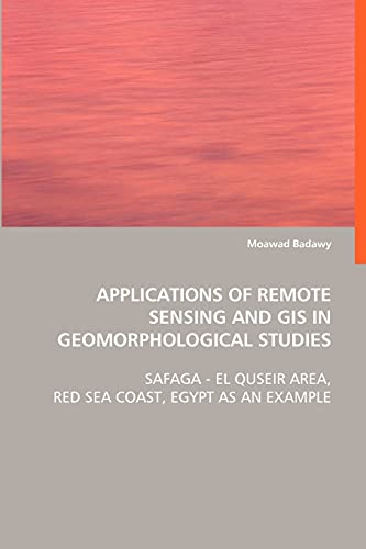
Items related to Applications of Remote Sensing and GIS in Geomorphological...

- PublisherVDM Verlag Dr. Mueller e.K.
- Publication date2008
- ISBN 10 3639060687
- ISBN 13 9783639060683
- BindingPaperback
- Number of pages308
Buy New
Learn more about this copy
Shipping:
£ 3.19
Within U.S.A.
Top Search Results from the AbeBooks Marketplace
Applications of Remote Sensing and GIS in Geomorphological Studies
Book Description Condition: New. Seller Inventory # ABLING22Oct2817100448116
Applications of Remote Sensing and GIS in Geomorphological Studies
Book Description PAP. Condition: New. New Book. Shipped from UK. THIS BOOK IS PRINTED ON DEMAND. Established seller since 2000. Seller Inventory # L0-9783639060683
Applications of Remote Sensing and GIS in Geomorphological Studies
Book Description Condition: New. PRINT ON DEMAND Book; New; Fast Shipping from the UK. No. book. Seller Inventory # ria9783639060683_lsuk
Applications of Remote Sensing and GIS inGeomorphological Studies
Book Description Taschenbuch. Condition: Neu. This item is printed on demand - it takes 3-4 days longer - Neuware -The present work represents an endeavour of applying remote sensing and geographic information systems (GIS) in geomorphological studies. Since the inception of the Landsat program in the early 1970s, remote sensing in particular has become an increasingly important tool for improving conventional methods of data collection and map production in geosciences. The potential of using remote sensing accompanied by GIS in geology and geomorphology has been long term discussed in the principal literatures e.g. Lillesand & Kieffer 1977-2000, Drury 1987-2001, Avery & Berlin 1992, Campell 1996, Easterbrook & Kovanen 1998, Jensen 2000, Sabins 2000, Janssen et al. 2001, Outtara et al. 2004, and Short 2005. The principal benefits of using remote sensing and GIS are that the automatic extraction of information using automatic classification, band ratioing, quantitative spectral analysis, easy digital integration with auxiliary data, and improving mapping and cartographic skills. Consequently, they are indispensable techniques for geomorphological and geological studies nowadays. 308 pp. Englisch. Seller Inventory # 9783639060683
Applications of Remote Sensing and GIS inGeomorphological Studies
Book Description Kartoniert / Broschiert. Condition: New. Dieser Artikel ist ein Print on Demand Artikel und wird nach Ihrer Bestellung fuer Sie gedruckt. Autor/Autorin: Badawy Moawadis a researcher and teacher for physical geography, remotensensing, and GIS in Ain Shams University, Cairo, Egypt. He hasnapplied GIS and remote sensing techniques in variety ofnenvironmental projects and activities. Seller Inventory # 4953725
Applications of Remote Sensing and GIS in Geomorphological Studies
Book Description PAP. Condition: New. New Book. Delivered from our UK warehouse in 4 to 14 business days. THIS BOOK IS PRINTED ON DEMAND. Established seller since 2000. Seller Inventory # L0-9783639060683
Applications of Remote Sensing and GIS inGeomorphological Studies : Safaga - El Quseir Area, Red Sea Coast, Egypt as anExample
Book Description Taschenbuch. Condition: Neu. nach der Bestellung gedruckt Neuware - Printed after ordering - The present work represents an endeavour of applying remote sensing and geographic information systems (GIS) in geomorphological studies. Since the inception of the Landsat program in the early 1970s, remote sensing in particular has become an increasingly important tool for improving conventional methods of data collection and map production in geosciences. The potential of using remote sensing accompanied by GIS in geology and geomorphology has been long term discussed in the principal literatures e.g. Lillesand & Kieffer 1977-2000, Drury 1987-2001, Avery & Berlin 1992, Campell 1996, Easterbrook & Kovanen 1998, Jensen 2000, Sabins 2000, Janssen et al. 2001, Outtara et al. 2004, and Short 2005. The principal benefits of using remote sensing and GIS are that the automatic extraction of information using automatic classification, band ratioing, quantitative spectral analysis, easy digital integration with auxiliary data, and improving mapping and cartographic skills. Consequently, they are indispensable techniques for geomorphological and geological studies nowadays. Seller Inventory # 9783639060683

