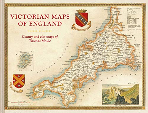
Items related to Victorian Maps of England: The county and city maps...

The most beautiful Victorian maps of England's counties and cities – in large format – by one of Britain's great cartographer's Thomas Moule.
Thomas Moule was one of the finest Victorian mapmakers and is regarded as the true follower of John Speed in the cartographic history of Britain. Moule’s beautifully observed county and city maps present a minutely detailed record of 19th-century England. They were first published in collectable parts between 1830 and 1837 and then published together in the extensive 2-volume masterwork The English Counties Delineated.
Moule celebrated the ‘ancientness’ and history of each county by including pastoral or monument views within the maps, all framed by cartouches, festoons and architectural ornament in a variety of historical styles. But underpinning this ancient vision is the hand of the British Industrial Revolution. Moule’s maps are deeply informed by the early technical work of the Ordnance Survey and record the unstoppable growth of the major cities and the unrelenting spread of the railways.
The maps have remained influential and highly collectable as both originals and as reproductions. For the first time in a generation this new large-format volume, comprising 55 county and city maps, presents the main body of Thomas Moule’s work alongside his original detailed text descriptions. The book’s Introduction explains Moule’s career as a writer and antiquary and sets his celebrated maps in the context of the technical cartographic revolution in which they were published. The book examines the wide-ranging artistic and cultural influences exhibited as Moule combines accurate cartography with highly decorative architectural frames and evocative, Romantic, pastoral views of the England he so cherished. In doing so it positions him alongside his fellow celebrated Victorian pioneers, including George Virtue, William Westall, Walter Scott, Charles Dickens, JMW Turner, Augustus Pugin, Edward Stanford and George Bradshaw.
"synopsis" may belong to another edition of this title.
Review:
'This large format volume is stupendous.' * Lets Talk! * 'This large-format map book perfectly exemplifies Victorian artistry in its awe-inspiring meticulousness.' * Geographical *
About the Author:
Thomas Moule was an antiquary and heraldry expert but is now principally remembered for his major contribution to cartography. Indeed he is celebrated, alongside John Speed and William Blaeu, as one of the great makers of maps of the British Isles and his work has remained popular and highly collectable since first publication.
Victorian Maps of England is introduced and edited by John Lee who has worked as a London publisher for some twenty years running the Conway Publishing list and more recently setting up the Pool of London Press and Velodrome Publishing. In that time he has commissioned and published a large number of award-winning exploration and cartographic volumes including the recent The Mapmakers World by Marjo Nurminen which won the prestigious Royal Geographic Society Fordham Award for expert cartography.
"About this title" may belong to another edition of this title.
- PublisherBatsford
- Publication date2018
- ISBN 10 1849944970
- ISBN 13 9781849944977
- BindingHardcover
- Number of pages160
Buy New
Learn more about this copy
� 17.44
Shipping:
� 3.15
Within U.S.A.
Top Search Results from the AbeBooks Marketplace
Stock Image
Victorian Maps of England: The Country & City Maps of Thomas Moule
Seller:
Rating
Book Description Condition: New. Fine. Hardcover with pictorial boards. 2018. Seller Inventory # W120488b
Buy New
� 17.44
Convert currency
Seller Image
Victorian Maps of England : The County and City Maps of Thomas Moule
Seller:
Rating
Book Description Condition: New. Seller Inventory # 31829080-n
Buy New
� 24.12
Convert currency
Stock Image
Victorian Maps of England: The County And City Maps Of Thomas Moule
Seller:
Rating
Book Description Hardcover. Condition: New. Brand New!. Seller Inventory # 1849944970
Buy New
� 26.27
Convert currency
Stock Image
Victorian Maps of England: The County And City Maps Of Thomas Moule
Seller:
Rating
Book Description Condition: New. . Seller Inventory # 52GZZZ00Y4WQ_ns
Buy New
� 26.85
Convert currency
Stock Image
Victorian Maps of England: The County And City Maps Of Thomas Moule
Seller:
Rating
Book Description Condition: New. Book is in NEW condition. 4.5. Seller Inventory # 1849944970-2-1
Buy New
� 30.71
Convert currency
Stock Image
Victorian Maps of England: The County And City Maps Of Thomas Moule
Seller:
Rating
Book Description Condition: New. New! This book is in the same immaculate condition as when it was published 4.5. Seller Inventory # 353-1849944970-new
Buy New
� 30.71
Convert currency
Stock Image
Victorian Maps of England (Hardcover)
Published by
Batsford Ltd, London
(2018)
ISBN 10: 1849944970
ISBN 13: 9781849944977
New
Hardcover
Quantity: 1
Seller:
Rating
Book Description Hardcover. Condition: new. Hardcover. The most beautiful Victorian maps of England's counties and cities by one of Britain's great cartographer's Thomas Moule. For the first time in a generation, the maps of the mid-19th century are reproduced to a very high standard in a large-format book. The maps are fascinating, decorative and hugely informative of an England in transformation with industrialization and the burgeoning railways. The 60 maps cover the counties of England plus key cities and are accompanied by contemporary descriptions as well as extracts on the counties from the Victorian age. It explores and explains Moule's career and development as a mapmaker and positions him alongside fellow celebrated Victorian pioneers including Brunel, Wedgewood, Bradshaw, Turner, Pugin, Blake, Scott and Wordsworth. Thomas Moule (1784-1851) is the finest Victorian mapmaker and is regarded as the true follower of John Speed in the cartographic history of Britain. Moule's beautifully observed county and city maps present a minutely detailed record of nineteenth-century England whilst also celebrating its 'ancientness' and history through pastoral or monument views all of which are framed within the cartouches, festoons and architecural ornament of the time. All, however, also show the progress of the Industrial revolution. The maps have remained most influential and highly collectable in both original and as reproductions. The most beautiful Victorian maps of England's counties and cities - in large format - by one of Britain's great cartographer's Thomas Moule. Shipping may be from multiple locations in the US or from the UK, depending on stock availability. Seller Inventory # 9781849944977
Buy New
� 30.74
Convert currency
Stock Image
Victorian Maps of England: County and City Maps of Thomas Moule
Seller:
Rating
Book Description Condition: New. Seller Inventory # 26383952111
Buy New
� 28.22
Convert currency
Stock Image
Victorian Maps of England: County and City Maps of Thomas Moule
Seller:
Rating
Book Description Condition: New. Seller Inventory # 378870576
Buy New
� 27.64
Convert currency
Stock Image
Victorian Maps of England: The County and City Maps of Thomas Moule
Published by
B T Batsford Ltd
(2018)
ISBN 10: 1849944970
ISBN 13: 9781849944977
New
Hardcover
Quantity: 1
Seller:
Rating
Book Description Hardcover. Condition: Brand New. 160 pages. 12.00x16.00x0.50 inches. In Stock. Seller Inventory # __1849944970
Buy New
� 25.69
Convert currency