Items related to Philip's Road Atlas Britain and Ireland 2011: Spiral...
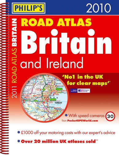
Philip's Road Atlas Britain and Ireland 2011: Spiral A4 - Softcover

 
9781849071109: Philip's Road Atlas Britain and Ireland 2011: Spiral A4
View all copies of this ISBN edition:
 
 
An atlas that contains 160 pages of road maps covering Britain at 3 miles to 1 inch, with the Western Isles, Orkney and Shetland at smaller scales, and marking service areas, roundabouts and multi-level junctions. It includes 10 pages of route-planning maps, a distance table, and 4 large-scale city approach maps with named arterial roads.

"synopsis" may belong to another edition of this title.

Book Description:
Fixed speed cameras shown on maps with speed limits. 160 pages of fully updated road maps at 3 miles to 1 inch. 52 town and city plans. 8 pages of city approach maps with named arterial roads. Exciting PR campaign to be announced.
About the Author:
Philip's publish a wide range of maps and atlases of streets and roads and of the world. They also publish books on astronomy, pocket reference books and encyclopaedias. Their titles reach a range of readerships: adults, children, general reference and educational for secondary and tertiary levels.

"About this title" may belong to another edition of this title.

  • PublisherPhilip's
  • Publication date2010
  • ISBN 10 1849071101
  • ISBN 13 9781849071109
  • BindingSpiral-bound
  • Number of pages224

Buy Used

Condition: Good
The book has been read but remains... Learn more about this copy

Shipping: £ 4.80
From United Kingdom to U.S.A.

Destination, rates & speeds

Add to Basket

Other Popular Editions of the Same Title

9781849071574: Philip's Road Atlas Britain and Ireland 2012: Spiral A4

Featured Edition

ISBN 10:  1849071578 ISBN 13:  9781849071574
Publisher: Philip's, 2011
Softcover

Top Search Results from the AbeBooks Marketplace

Stock Image

Philip's Maps
Published by Philips (2010)
ISBN 10: 1849071101 ISBN 13: 9781849071109
Used Paperback Quantity: 1
Seller:
WorldofBooks
(Goring-By-Sea, WS, United Kingdom)

Book Description Paperback. Condition: Good. The book has been read but remains in clean condition. All pages are intact and the cover is intact. Some minor wear to the spine. Seller Inventory # GOR003377408

More information about this seller | Contact seller

Buy Used
£ 1.38
Convert currency

Add to Basket

Shipping: £ 4.80
From United Kingdom to U.S.A.
Destination, rates & speeds
Stock Image

Philip's Maps
Published by Philips (2010)
ISBN 10: 1849071101 ISBN 13: 9781849071109
Used Paperback Quantity: 3
Seller:
WorldofBooks
(Goring-By-Sea, WS, United Kingdom)

Book Description Paperback. Condition: Very Good. The book has been read, but is in excellent condition. Pages are intact and not marred by notes or highlighting. The spine remains undamaged. Seller Inventory # GOR004468684

More information about this seller | Contact seller

Buy Used
£ 1.38
Convert currency

Add to Basket

Shipping: £ 4.80
From United Kingdom to U.S.A.
Destination, rates & speeds
Stock Image

Philips
Published by Philips (2010)
ISBN 10: 1849071101 ISBN 13: 9781849071109
Used Softcover Quantity: 2
Seller:
Better World Books Ltd
(Dunfermline, United Kingdom)

Book Description Condition: Good. Ships from the UK. Former library book; may include library markings. Used book that is in clean, average condition without any missing pages. Seller Inventory # 38451468-20

More information about this seller | Contact seller

Buy Used
£ 3.77
Convert currency

Add to Basket

Shipping: £ 8
From United Kingdom to U.S.A.
Destination, rates & speeds