Items related to Pemberton 1927: Lancashire Sheet 93.11b (Old Ordnance...
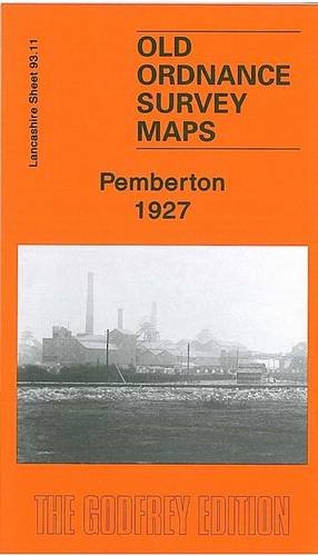

Here are the details of maps for Pemberton: Lancashire Sheet 93.11a Pemberton 1907 - published 2000; intro by Paul Hindle. ISBN.978-1-84151-227-3 Lancashire Sheet 93.11b Pemberton 1927 - published 2010; intro by Alan Godfrey. ISBN.978-1-84784-356-2 We have published two versions of this highly detailed map, showing how the area changed across the years. Coverage runs from Pemberton station eastward to Pool Street and Poolstock; and from the Ormskirk Road southward to Goose Green. This is a busy map with several mineral railways. Pemberton Collieries are a major feature, incl Queen Pit, King Pit and Prince Pit. Other features include a stretch of the Liverpool-Bolton railway, incl Pemberton station, the LNWR Norley Branch, Winstanley Colliery Railway, Worsley Mesnes Colliery with mineral line, Worsley Mesnes Iron Works, several tramways, Pemberton Stone Quarries, Smithy Brook, Alexandra Park, May Mill, Blundell's Wood, Worsley Mesnes Mill, Poolstock Mill, St James church, Highfield area, Goose Green area, Worsley Mesnes area etc. Extracts from a 1910 directory, incl Billinge Road, Enfield Street, Ormskirk Road, Queen Street, Westminster Street, are included on the reverse of the 1907 map. A 1918 directory of Pemberton is on the reverse of the 1927 map..
"synopsis" may belong to another edition of this title.
- PublisherAlan Godfrey Maps
- Publication date2010
- ISBN 10 1847843565
- ISBN 13 9781847843562
- BindingMap
Buy New
Learn more about this copy
� 2.75
Shipping:
� 30.45
From United Kingdom to U.S.A.
Top Search Results from the AbeBooks Marketplace
Stock Image
Pemberton 1927: Lancashire Sheet 93.11b (Old Ordnance Survey Maps of Lancashire)
Seller:
Rating
Book Description No Binding. Condition: New. No Jacket. Here are the details of maps for Pemberton: Lancashire Sheet 93.11a Pemberton 1907 - published 2000; intro by Paul Hindle. ISBN.978-1-84151-227-3 Lancashire Sheet 93.11b Pemberton 1927 - published 2010; intro by Alan Godfrey. ISBN.978-1-84784-356-2 We have published two versions of this highly detailed map, showing how the area changed across the years. Coverage runs from Pemberton station eastward to Pool Street and Poolstock; and from the Ormskirk Road southward to Goose Green. This is a busy map with several mineral railways. Pemberton Collieries are a major feature, incl Queen Pit, King Pit and Prince Pit. Other features include a stretch of the Liverpool-Bolton railway, incl Pemberton station, the LNWR Norley Branch, Winstanley Colliery Railway, Worsley Mesnes Colliery with mineral line, Worsley Mesnes Iron Works, several tramways, Pemberton Stone Quarries, Smithy Brook, Alexandra Park, May Mill, Blundell's Wood, Worsley Mesnes Mill, Poolstock Mill, St James church, Highfield area, Goose Green area, Worsley Mesnes area etc. Extracts from a 1910 directory, incl Billinge Road, Enfield Street, Ormskirk Road, Queen Street, Westminster Street, are included on the reverse of the 1907 map. A 1918 directory of Pemberton is on the reverse of the 1927 map. The map links up with sheets 93.07 Wigan West to the north, 93.10 Lamberhead Green to the west, 93.12 Ince in Makerfield to the east, 93.15 Marus Bridge to the south. Seller Inventory # 000664
Buy New
� 2.75
Convert currency