Items related to Map of the Inland Waterways of Great Britain
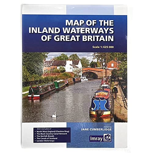

First published over 60 years ago when interest in reviving Britain's network of navigable and rivers was starting to gather pace, this map provides the best coverage of the system in England, Wales and Scotland. Distances, the number of locks and restricting dimensions are given for each waterway. The simple cartography defines rivers, broad and narrow canals against generalized relief and the major road network. The 2016 edition has been updated to show progress in restoration schemes and other changes.
"synopsis" may belong to another edition of this title.
- PublisherImray, Laurie, Norie & Wilson Ltd
- Publication date2016
- ISBN 10 1846238277
- ISBN 13 9781846238277
- BindingPaperback
- Number of pages1
Buy New
Learn more about this copy
� 10.95
Shipping:
� 4.50
From United Kingdom to U.S.A.
Top Search Results from the AbeBooks Marketplace
Stock Image
Map of the Inland Waterways of Great Britain
Published by
Imray, Laurie, Norie & Wilson Ltd 2016-05-04
(2016)
ISBN 10: 1846238277
ISBN 13: 9781846238277
New
paperback
Quantity: 5
Seller:
Rating
Book Description paperback. Condition: New. Seller Inventory # 9781846238277
Buy New
� 10.95
Convert currency
Seller Image
Map of the Inland Waterways of Great Britain by Cumberlidge, Jane [Paperback ]
Published by
Imray, Laurie, Norie & Wilson Ltd
(2016)
ISBN 10: 1846238277
ISBN 13: 9781846238277
New
Soft Cover
Quantity: 10
Seller:
Rating
Book Description Soft Cover. Condition: new. Seller Inventory # 9781846238277
Buy New
� 16.27
Convert currency
Stock Image
Map of the Inland Waterways of Great Britain
Published by
Imray, Laurie, Norie and Wilson Ltd
(2016)
ISBN 10: 1846238277
ISBN 13: 9781846238277
New
PAP
Quantity: 1
Seller:
Rating
Book Description PAP. Condition: New. New Book. Shipped from UK. Established seller since 2000. Seller Inventory # EA-9781846238277
Buy New
� 16.61
Convert currency
Stock Image
Map of the Inland Waterways of Great Britain
Published by
Imray, Laurie, Norie & Wilson Ltd
(2016)
ISBN 10: 1846238277
ISBN 13: 9781846238277
New
Paperback / softback
Quantity: 4
Seller:
Rating
Book Description Paperback / softback. Condition: New. New copy - Usually dispatched within 4 working days. First published over 60 years ago when interest in reviving Britain's network of navigable and rivers was starting to gather pace, this map provides the best coverage of the system in England, Wales and Scotland. Distances, the number of locks and restricting dimensions are given for each waterway. Seller Inventory # B9781846238277
Buy New
� 13.06
Convert currency
Stock Image
Map of the Inland Waterways of Great Britain
Published by
Imray, Laurie, Norie & Wilson Ltd
(2016)
ISBN 10: 1846238277
ISBN 13: 9781846238277
New
Softcover
Quantity: 10
Seller:
Rating
Book Description Condition: new. Seller Inventory # A58D5HODQS
Buy New
� 15.55
Convert currency
Stock Image
Map of the Inland Waterways of Great Britain
Published by
Imray, Laurie, Norie & Wilson Ltd
(2016)
ISBN 10: 1846238277
ISBN 13: 9781846238277
New
Paperback
Quantity: 1
Seller:
Rating
Book Description Paperback. Condition: Brand New. 1 pages. 10.16x7.40x0.47 inches. In Stock. Seller Inventory # zk1846238277
Buy New
� 16.41
Convert currency
Stock Image
Map of the Inland Waterways of Great Britain
Published by
Imray, Laurie, Norie and Wilson Ltd
(2016)
ISBN 10: 1846238277
ISBN 13: 9781846238277
New
PAP
Quantity: 1
Seller:
Rating
Book Description PAP. Condition: New. New Book. Shipped from UK. Established seller since 2000. Seller Inventory # EA-9781846238277
Buy New
� 14.87
Convert currency
Seller Image
Map of the Inland Waterways of Great Britain (Paperback)
Published by
Imray, Laurie, Norie & Wilson Ltd, Huntingdon
(2016)
ISBN 10: 1846238277
ISBN 13: 9781846238277
New
Paperback
Quantity: 1
Seller:
Rating
Book Description Paperback. Condition: new. Paperback. First published over 60 years ago when interest in reviving Britain's network of navigable and rivers was starting to gather pace, this map provides the best coverage of the system in England, Wales and Scotland. Distances, the number of locks and restricting dimensions are given for each waterway. The simple cartography defines rivers, broad and narrow canals against generalized relief and the major road network. The 2016 edition has been updated to show progress in restoration schemes and other changes. First published over 60 years ago when interest in reviving Britain's network of navigable and rivers was starting to gather pace, this map provides the best coverage of the system in England, Wales and Scotland. Distances, the number of locks and restricting dimensions are given for each waterway. Shipping may be from our Sydney, NSW warehouse or from our UK or US warehouse, depending on stock availability. Seller Inventory # 9781846238277
Buy New
� 20.86
Convert currency
Seller Image
Map of the Inland Waterways of Great Britain (Paperback)
Published by
Imray, Laurie, Norie & Wilson Ltd, Huntingdon
(2016)
ISBN 10: 1846238277
ISBN 13: 9781846238277
New
Paperback
Quantity: 1
Seller:
Rating
Book Description Paperback. Condition: new. Paperback. First published over 60 years ago when interest in reviving Britain's network of navigable and rivers was starting to gather pace, this map provides the best coverage of the system in England, Wales and Scotland. Distances, the number of locks and restricting dimensions are given for each waterway. The simple cartography defines rivers, broad and narrow canals against generalized relief and the major road network. The 2016 edition has been updated to show progress in restoration schemes and other changes. First published over 60 years ago when interest in reviving Britain's network of navigable and rivers was starting to gather pace, this map provides the best coverage of the system in England, Wales and Scotland. Distances, the number of locks and restricting dimensions are given for each waterway. Shipping may be from our UK warehouse or from our Australian or US warehouses, depending on stock availability. Seller Inventory # 9781846238277
Buy New
� 14.49
Convert currency
Stock Image
MAP OF THE INLAND WATERWAYS GR BRITAIN
Published by
Imray, Laurie, Norie & Wilson Ltd
(2016)
ISBN 10: 1846238277
ISBN 13: 9781846238277
New
Softcover
Quantity: 10
Seller:
Rating
Book Description Condition: NEW. Seller Inventory # NW9781846238277
Buy New
� 11.86
Convert currency