Items related to A Collection of Four Historic Maps of Norfolk from...
A Collection of Four Historic Maps of Norfolk from 1611 - 1836: 23 (Historic English Counties Maps Collection) - Softcover
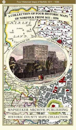

This folded map (890mm x 1000mm when unfolded) is an ideal souvenir for tourists to Norfolk and also a valuable reference resource for local and family history research. It includes 4 Historic maps of Norfolk, John Speed's County Map of Norfolk 1611, Johan Blaeu's County Map of Norfolk 1648, Thomas Moule's County Map of Norfolk 1836 and the detailed Plan of The City of Norwich 1807 by Cole and Roper. All the maps have been meticulously re-produced from antique originals and printed on 90 gsm "Progeo" paper which was specially developed as a map paper. It has high opacity to help reduce show through and a cross grain giving it greater durability to as the map is being folded.
"synopsis" may belong to another edition of this title.
- PublisherMapseeker Archive Publishing
- Publication date2019
- ISBN 10 1844918467
- ISBN 13 9781844918461
- BindingPaperback
- Number of pages1
Buy New
Learn more about this copy
� 34.07
Shipping:
� 10
From United Kingdom to U.S.A.
Top Search Results from the AbeBooks Marketplace
Stock Image
A Collection of Four Historic Maps of Norfolk from 1611 - 1836 (Historic English Counties Maps Collection)
Published by
Mapseeker Archive Publishing
(2019)
ISBN 10: 1844918467
ISBN 13: 9781844918461
New
Paperback
Quantity: 1
Seller:
Rating
Book Description Paperback. Condition: Brand New. 1 pages. 8.86x5.28x0.59 inches. In Stock. Seller Inventory # zk1844918467
Buy New
� 34.07
Convert currency
Stock Image
A Collection of Four Historic Maps of Norfolk from 1611 - 1836 (Historic English Counties Maps Collection)
Published by
Mapseeker Archive Publishing
(2019)
ISBN 10: 1844918467
ISBN 13: 9781844918461
New
Quantity: 1
Seller:
Rating
Book Description No Binding. Condition: New. Description This folded map (890mm x 1000mm when unfolded) is an ideal souvenir for tourists to Norfolk and also a valuable reference resource for local and family history research. It includes 4 Historic maps of Norfolk, John Speed?s County Map of Norfolk 1611, Johan Blaeu?s County Map of Norfolk 1648, Thomas Moule?s County Map of Norfolk 1836 and the detailed Plan of The City of Norwich 1807 by Cole and Roper. All the maps have been meticulously re-produced from antique originals and printed on 90 gsm ?Progeo? paper which was specially developed as a map paper. It has high opacity to help reduce show through and a cross grain giving it greater durability to as the map is being folded. Seller Inventory # 000060
Buy New
� 14.99
Convert currency
Stock Image
A Collection of Four Historic Maps of Norfolk from 1611 - 1836 (Historic English Counties Maps Collection)
Published by
Mapseeker Archive Publishing
(2019)
ISBN 10: 1844918467
ISBN 13: 9781844918461
New
Softcover
Quantity: 1
Seller:
Rating
Book Description Condition: New. Book is in NEW condition. Seller Inventory # 1844918467-2-1
Buy New
� 54.44
Convert currency