Items related to South East England Regional Road Atlas

This regional road atlas of South East England covers an area extending to:
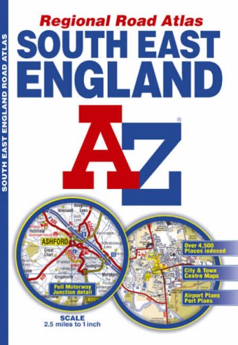
- Banbury, Milton Keynes, Letchworth Garden City, Sudbury, Felixstowe, Clacton-on-Sea, Southend-on-Sea, Ramsgate, Folkestone, Hastings, Brighton, Portsmouth, Cowes, Southampton, Winchester, Newbury and Oxford.
Map information includes:
- motorways open with full junction detail, motorways under construction and proposed, service areas, primary routes and destinations, A & B roads, safety camera locations with their maximum speed limit, gradients 1:5 and steeper, tolls, mileages, county boundaries, spot heights and contour colouring. There is a wide range of ancillary and tourist information shown on the mapping.
The index section lists cities, towns, villages, hamlets and locations covered by the road mapping.
The town and city centre plans section includes:
- Brighton & Hove, Canterbury, Dover, Eastbourne, Folkestone, Guildford, London, Medway Towns, Milton Keynes, Oxford, Portsmouth, Reading, Southampton, Winchester and Windsor. Also featured are airport plans of London Gatwick, London Heathrow, London Luton and London Stansted with port plans of Newhaven and Portsmouth. The plans in this section also feature safety cameras with their maximum speed limit.
"synopsis" may belong to another edition of this title.
- PublisherGeographers A-Z Map Company
- Publication date2009
- ISBN 10 1843485281
- ISBN 13 9781843485285
- BindingPaperback
- Number of pages72
Top Search Results from the AbeBooks Marketplace

Stock Image
South East England Regional Road Atlas
Published by
Geographers' A-Z Map Co Ltd
(2007)
ISBN 10: 1843485281
ISBN 13: 9781843485285
Used
Softcover
Quantity: 1
Seller:
Rating
Book Description Condition: Good. 10th edition. Ships from the UK. Used book that is in clean, average condition without any missing pages. Seller Inventory # 18627361-20
Buy Used
� 3.29
Convert currency
Stock Image
South East England Regional Road Atlas Geographers A-Z Map Company
Published by
Geographers A-Z Map Company
(2009)
ISBN 10: 1843485281
ISBN 13: 9781843485285
Used
Paperback
Quantity: 1
Seller:
Rating
Book Description Paperback. Condition: Very Good. Book is in very good condition. All pages are intact and unmarked. Seller Inventory # G0179461
Buy Used
� 3.47
Convert currency