Items related to Appalachian Mountain Club White Mountains Trail Map:...
Appalachian Mountain Club White Mountains Trail Map: Map 2: Franconia-Pemigewasset (Appalachian Mountain Club White Mountain Trail Maps)
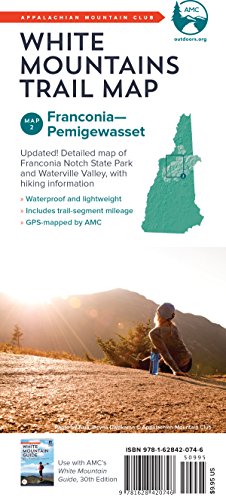

Waterproof and lightweight, this Franconia-Pemigewasset map includes detailed maps of Franconia Notch State Park and Waterville Valley, as well as hiking information. Printed in full-color on waterproof Tyvek, this fully updated map includes comprehensive trail coverage of the stunning Pemigewasset Wilderness Area along with the popular Kancamagus Highway. On the reverse are detailed maps of Franconia Notch State Park and Waterville Valley, plus safety and planning tips and emergency information. GPS-rendered, this map is tear-resistant, has an easy-to-read scale, and includes trail segment mileage.
"synopsis" may belong to another edition of this title.
- PublisherAppalachian Mountain Club
- Publication date2017
- ISBN 10 162842074X
- ISBN 13 9781628420746
- BindingMap
Top Search Results from the AbeBooks Marketplace

Seller Image
AMC White Mountains Trail Map 2: FranconiaPemigewasset (Appalachian Mountain Club White Mountain Trail Maps) by Appalachian Mountain Club Books [Map ]
Published by
Appalachian Mountain Club Books
(2017)
ISBN 10: 162842074X
ISBN 13: 9781628420746
New
No Binding
Quantity: 10
Seller:
Rating
Book Description No Binding. Condition: new. Seller Inventory # 9781628420746
Buy New
� 8.69
Convert currency
Stock Image
AMC WHITE MOUNTAINS TRAIL MAP:MAP 2 FRAN
Published by
National Book Network
(2017)
ISBN 10: 162842074X
ISBN 13: 9781628420746
New
Quantity: > 20
Seller:
Rating
Book Description Condition: New. Brand New. Seller Inventory # 162842074X
Buy New
� 5.82
Convert currency
Seller Image
Amc White Mountains Trail Map (Folded)
Published by
Appalachian Mountain Club
(2017)
ISBN 10: 162842074X
ISBN 13: 9781628420746
New
Quantity: 1
Seller:
Rating
Book Description Folded. Condition: new. Folded. Waterproof and lightweight, this Franconia-Pemigewasset map includes detailed maps of Franconia Notch State Park and Waterville Valley, as well as hiking information. Printed in full-color on waterproof Tyvek, this fully updated map includes comprehensive trail coverage of the stunning Pemigewasset Wilderness Area along with the popular Kancamagus Highway. On the reverse are detailed maps of Franconia Notch State Park and Waterville Valley, plus safety and planning tips and emergency information. GPS-rendered, this map is tear-resistant, has an easy-to-read scale, and includes trail segment mileage. Shipping may be from multiple locations in the US or from the UK, depending on stock availability. Seller Inventory # 9781628420746
Buy New
� 11.54
Convert currency
Stock Image
AMC White Mountains Trail Map 2: FranconiaPemigewasset
Published by
Appalachian Mountain Club Books
(2017)
ISBN 10: 162842074X
ISBN 13: 9781628420746
New
Quantity: 15
Seller:
Rating
Book Description Condition: New. Seller Inventory # V9781628420746
Buy New
� 17.42
Convert currency
Stock Image
AMC White Mountains Trail Map 2: Franconia?Pemigewasset (Appalachian Mountain Club White Mountain Trail Maps)
Published by
Appalachian Mountain Club Books
(2017)
ISBN 10: 162842074X
ISBN 13: 9781628420746
New
Quantity: 1
Seller:
Rating
Book Description Condition: New. Book is in NEW condition. Seller Inventory # 162842074X-2-1
Buy New
� 26.05
Convert currency
Stock Image
AMC White Mountains Trail Map 2: FranconiaPemigewasset
Published by
Appalachian Mountain Club Books
(2017)
ISBN 10: 162842074X
ISBN 13: 9781628420746
New
Quantity: 15
Seller:
Rating
Book Description Condition: New. Seller Inventory # V9781628420746
Buy New
� 19.73
Convert currency
Stock Image
Appalachian Mountain Club White Mountains Trail Map: Map 2: Franconia-Pemigewasset
Published by
Appalachian Mountain Club
(2017)
ISBN 10: 162842074X
ISBN 13: 9781628420746
New
Paperback
Quantity: 1
Seller:
Rating
Book Description Paperback. Condition: Brand New. fol map edition. 9.00x4.00x0.25 inches. In Stock. Seller Inventory # 162842074X
Buy New
� 18.92
Convert currency