Items related to Yosemite Se, Ansel Adams Wilderness: Trails Illustrated...
Yosemite Se, Ansel Adams Wilderness: Trails Illustrated National Parks (National Geographic Trails Illustrated Map)
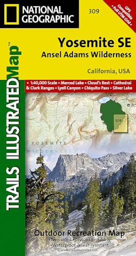

� Waterproof � Tear-Resistant � Topographic Map
Coverage of the Tuolomne Meadows and Hoover Wilderness area of Yosemite National Park includes Ansel Adams Wilderness, Yosemite Wilderness, Mono Basin National Forest Scenic Area, Monroe Hall Research Natural Area, Humbolt - Toiyabe National Forest, Twin Lakes. Includes UTM grids for use with your GPS unit.
Coverage of the Tuolomne Meadows and Hoover Wilderness area of Yosemite National Park includes Ansel Adams Wilderness, Yosemite Wilderness, Mono Basin National Forest Scenic Area, Monroe Hall Research Natural Area, Humbolt - Toiyabe National Forest, Twin Lakes. Includes UTM grids for use with your GPS unit.
- Map Scale = 1:40,000
- Sheet Size = 36" x 22"
- Folded Size = 4" x 7.5"
"synopsis" may belong to another edition of this title.
- PublisherNational Geographic Maps
- Publication date2012
- ISBN 10 1566954134
- ISBN 13 9781566954136
- BindingMap
- Number of pages1
Top Search Results from the AbeBooks Marketplace

Stock Image
Yosemite SE: Ansel Adams Wilderness (National Geographic Trails Illustrated Map)
Published by
National Geographic Maps
(2016)
ISBN 10: 1566954134
ISBN 13: 9781566954136
New
Quantity: 1
Seller:
Rating
Book Description Map. Condition: New. Seller Inventory # DADAX1566954134
Buy New
� 12.57
Convert currency