Items related to Glasgow Streetfinder Colour Atlas
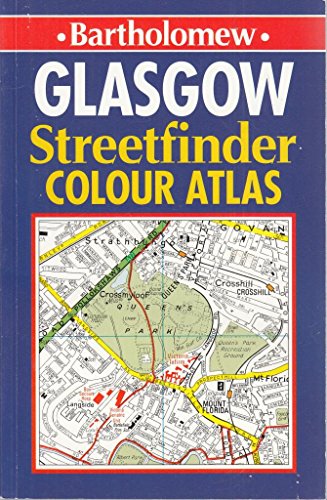

This atlas of the city of Glasgow has a four-inch-to-one-mile scale, four-colour mapping and roads colour-classified for easy reference. An index of all street names and an information guide to the city and surrounding area, with details of parking, places of interest to visit, and leisure and entertainment facilities, are included.
"synopsis" may belong to another edition of this title.
From the Back Cover:
MAIN FEATURES
� Full colour street atlas with roads colour classified at 4 inches to 1 mile
� Full index to street names
� Local information pages
� Map of Strathclyde Transport Rail Network
� Map of Glasgow Airport
INCLUDES
� One way streets
� Car parks, railway and bus stations
� Post offices, police stations and fire stations plotted
AREA OF COVERAGE
The atlas covers an extensive area, including Cumbernauld in the north, Clydebank in the north west, Johnstone in the west, Easterhouse and Uddingston in the east and Barrhead and Giffnock in the south.
WHO THE PRODUCT IS AIMED AT
Essential for residents and business users alike. Also useful for anyone visiting and driving around the city on a regular basis.
"About this title" may belong to another edition of this title.
- PublisherBartholomew
- Publication date1994
- ISBN 10 0702827886
- ISBN 13 9780702827884
- BindingPaperback
- Number of pages144
Top Search Results from the AbeBooks Marketplace

Stock Image
Glasgow Streetfinder Colour Atlas
Published by
Bartholomew 02/06/1994
(1994)
ISBN 10: 0702827886
ISBN 13: 9780702827884
Used
Softcover
Quantity: 1
Seller:
Rating
Book Description Condition: Very Good. This book is in very good condition and will be shipped within 24 hours of ordering. The cover may have some limited signs of wear but the pages are clean, intact and the spine remains undamaged. This book has clearly been well maintained and looked after thus far. Money back guarantee if you are not satisfied. See all our books here, order more than 1 book and get discounted shipping. . Seller Inventory # 7719-9780702827884
Buy Used
� 3.18
Convert currency
Stock Image
Glasgow Streetfinder Colour Atlas
Published by
Bartholomew
(1994)
ISBN 10: 0702827886
ISBN 13: 9780702827884
Used
Softcover
Quantity: 1
Seller:
Rating
Book Description Condition: Very Good. 1710249919. 3/12/2024 1:25:19 PM. Seller Inventory # U9780702827884
Buy Used
� 3.35
Convert currency
Stock Image
Glasgow Streetfinder Colour Atlas
Published by
Bartholomew 02/06/1994
(1994)
ISBN 10: 0702827886
ISBN 13: 9780702827884
Used
Softcover
Quantity: 1
Seller:
Rating
Book Description Condition: Very Good. Shipped within 24 hours from our UK warehouse. Clean, undamaged book with no damage to pages and minimal wear to the cover. Spine still tight, in very good condition. Remember if you are not happy, you are covered by our 100% money back guarantee. Seller Inventory # 6545-9780702827884
Buy Used
� 3.18
Convert currency
Stock Image
Glasgow Streetfinder Colour Atlas
Published by
Bartholomew
(1994)
ISBN 10: 0702827886
ISBN 13: 9780702827884
Used
Paperback
Quantity: 1
Seller:
Rating
Book Description Paperback. Condition: Good. Seller Inventory # mon0000078529
Buy Used
� 5
Convert currency