Items related to London Pocket Map
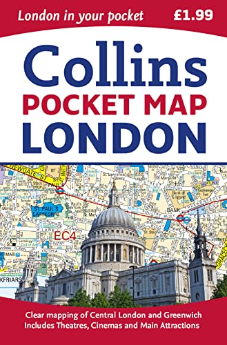

Handy little full colour map of central London with a high level of detail. Clear mapping of central London from Regent’s Park in the north to Kennington in the south, and Kensington Gardens in the west to Tower Bridge in the east at a scale of 1:12,500 (5 inches to 1 mile). Maps of West End shopping and theatres are also included.
Clear, detailed, full colour mapping is presented in a handy format ideal for the pocket or handbag. It is excellent value at only �1.99 and covers the most visited area of central London. It is an essential buy for tourists and residents alike.
INCLUDES
� Detailed central area map
� Theatres and cinemas map
� Shopping map
� Underground map
� The latest congestion zone boundary
"synopsis" may belong to another edition of this title.
About the Author:
Explore the world through accurate and up-to-date mapping.
"About this title" may belong to another edition of this title.
- PublisherCollins
- Publication date2015
- ISBN 10 0008104565
- ISBN 13 9780008104566
- BindingMap
- Number of pages96
- Rating
Top Search Results from the AbeBooks Marketplace

Stock Image
London Pocket Map
Seller:
Rating
Book Description Map. Condition: Used; Good. **SHIPPED FROM UK** We believe you will be completely satisfied with our quick and reliable service. All orders are dispatched as swiftly as possible! Buy with confidence! Greener Books. Seller Inventory # 4311229
Buy Used
� 3.18
Convert currency
Stock Image
London Pocket Map
Published by
HarperCollins Publishers, United Kingdom, London
(2015)
ISBN 10: 0008104565
ISBN 13: 9780008104566
Used
Paperback
Quantity: 2
Seller:
Rating
Book Description Paperback. Condition: Very Good. Handy little full colour map of central London with a high level of detail. Clear mapping of central London from Regents Park in the north to Kennington in the south, and Kensington Gardens in the west to Tower Bridge in the east at a scale of 1:12,500 (5 inches to 1 mile). Maps of West End shopping and theatres are also included. Clear, detailed, full colour mapping is presented in a handy format ideal for the pocket or handbag. It is excellent value at only 1.99 and covers the most visited area of central London. It is an essential buy for tourists and residents alike. INCLUDES Detailed central area map Theatres and cinemas map Shopping map Underground map The latest congestion zone boundary. The book has been read, but is in excellent condition. Pages are intact and not marred by notes or highlighting. The spine remains undamaged. Seller Inventory # GOR007705089
Buy Used
� 10.34
Convert currency