Items related to 2016 Collins Map of Britain
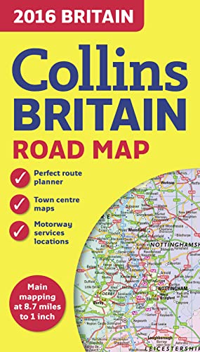

Full colour double-sided map of Great Britain at 8.7 miles to 1 inch (1:550,000), with clear, detailed road network and administrative areas shown in colour.
With its political colouring of counties and unitary authorities it is ideal for business users but it is also perfect for tourists as a route planning map.
MAIN FEATURES
� Fully updated for 2016.
� Counties and local council areas shown in colour.
� Clear, detailed road network.
� Town and city names, rivers, railway lines and canals are clearly shown.
� 16 city/town centre street plans.
� Index to place names.
� Mileage chart.
� Car ferry routes.
� Key in English, French and German.
AREA OF COVERAGE
Double-sided road map covering the whole of Britain. Northern England, Scotland and the Isle of Man are on one side with Southern England and Wales on the other.
"synopsis" may belong to another edition of this title.
About the Author:
Explore the world through accurate and up-to-date mapping.
"About this title" may belong to another edition of this title.
- PublisherCollins
- Publication date2015
- ISBN 10 0008102333
- ISBN 13 9780008102333
- BindingMap
- Rating
Top Search Results from the AbeBooks Marketplace

Stock Image
2016 Collins Map of Britain
Published by
HarperCollins UK
(2016)
ISBN 10: 0008102333
ISBN 13: 9780008102333
Used
Paperback
Quantity: 2
Seller:
Rating
Book Description Paperback. Condition: Good. The book has been read but remains in clean condition. All pages are intact and the cover is intact. Some minor wear to the spine. Seller Inventory # GOR007587630
Buy Used
� 5.46
Convert currency
Stock Image
2016 Collins Map of Britain
Published by
HarperCollins UK
(2016)
ISBN 10: 0008102333
ISBN 13: 9780008102333
Used
Paperback
Quantity: 1
Seller:
Rating
Book Description Paperback. Condition: Fair. A readable copy of the book which may include some defects such as highlighting and notes. Cover and pages may be creased and show discolouration. Seller Inventory # GOR012026176
Buy Used
� 5.46
Convert currency
Stock Image
2016 Collins Map of Britain
Published by
HarperCollins Publishers, United Kingdom, London
(2015)
ISBN 10: 0008102333
ISBN 13: 9780008102333
Used
Paperback
Quantity: 3
Seller:
Rating
Book Description Paperback. Condition: Very Good. Full colour double-sided map of Great Britain at 8.7 miles to 1 inch (1:550,000), with clear, detailed road network and administrative areas shown in colour. With its political colouring of counties and unitary authorities it is ideal for business users but it is also perfect for tourists as a route planning map. MAIN FEATURES Fully updated for 2016. Counties and local council areas shown in colour. Clear, detailed road network. Town and city names, rivers, railway lines and canals are clearly shown. 16 city/town centre street plans. Index to place names. Mileage chart. Car ferry routes. Key in English, French and German. AREA OF COVERAGE Double-sided road map covering the whole of Britain. Northern England, Scotland and the Isle of Man are on one side with Southern England and Wales on the other. The book has been read, but is in excellent condition. Pages are intact and not marred by notes or highlighting. The spine remains undamaged. Seller Inventory # GOR007652999
Buy Used
� 10.92
Convert currency