Items related to Collins London Pocket Atlas

Clear street maps of Central London and surrounding area in this fully updated atlas. Street mapping shown, from Chiswick in the West to Barking in the East and Hampstead in the North to Dulwich in the South, at a scale of 1:20,000 (3.17 inches to 1 mile) and Central London at 1:12,500 (5.1 inches to 1 mile).
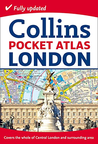
This neat, handy little pocket-sized atlas is an ideal purchase for resident and visitor alike. It has an extensive area of coverage and shows the centre of London at an extra large scale. The maps are exceptionally clear and easy to use with colour coding for both the roads as well as locations such as shops, hospitals, hotels, schools etc.
INCLUDES
� The new Olympic Park.
� Latest boundary of the congestion charging zone.
� Colour classified roads and buildings.
� Postal district boundaries.
� Car parks, hospitals and police stations.
� Tourist information centres.
� Updated underground map on back cover.
� Full index to street names.
AREA OF COVERAGE
Extends from Chiswick in the west to Barking in the east and Hampstead in the north to Dulwich in the south.
"synopsis" may belong to another edition of this title.
About the Author:
Explore the world through accurate and up-to-date mapping.
"About this title" may belong to another edition of this title.
- PublisherCollins
- Publication date2012
- ISBN 10 0007452454
- ISBN 13 9780007452453
- BindingPaperback
- Number of pages144
- Rating
Top Search Results from the AbeBooks Marketplace

Stock Image
Collins London Pocket Atlas (Collins Travel Guides)
Published by
HarperCollins UK
(2012)
ISBN 10: 0007452454
ISBN 13: 9780007452453
New
Softcover
Quantity: 1
Seller:
Rating
Book Description Condition: New. . Seller Inventory # 52GZZZ00XP5W_ns
Buy New
� 21.71
Convert currency
Stock Image
Collins London Pocket Atlas (Collins Travel Guides)
Published by
HarperCollins UK
(2012)
ISBN 10: 0007452454
ISBN 13: 9780007452453
New
Paperback
Quantity: 1
Seller:
Rating
Book Description Paperback. Condition: new. New. Seller Inventory # Wizard0007452454
Buy New
� 26.25
Convert currency
Stock Image
Collins London Pocket Atlas (Collins Travel Guides)
Published by
HarperCollins UK
(2012)
ISBN 10: 0007452454
ISBN 13: 9780007452453
New
Paperback
Quantity: 1
Seller:
Rating
Book Description Paperback. Condition: new. New Copy. Customer Service Guaranteed. Seller Inventory # think0007452454
Buy New
� 32.99
Convert currency