Items related to Comprehensive Road Atlas Ireland
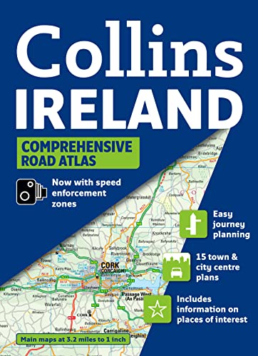

Clear, detailed road mapping of Ireland presented as an A4 format road atlas featuring attractive layer colouring to show land height. Speed enforcement zones are also shown on the mapping.
Along with the road mapping there is also a wide range of detailed town and city centre plans, all of which are fully indexed.
MAIN FEATURES
Detailed, general purpose road map of Ireland in a handy A4 format. Ideal for both business and pleasure use. The atlas contains a range of mapping scales:
� 9 miles to 1inch route planning map
� Main maps at 3.2 miles to 1 inch whicha re ideal for navigation.
� Plus a wide selection of detailed town centre street plans.
The 2009 edition includes the location of safety cameras and also Speed Enforcement Zones, which highlight roads that have a high risk of accidents as identified by the Garda and the National Roads Authority. Also new for 2009 is the addition of Blue Flag and Green Coast beaches, ideal for holiday makers. These have been evaluated for their water quality and safety, and, in the case of Blue Flag beaches, for their amenities such as life guards and toilets.
The main road mapping is packed with detail showing:
� comprehensive colour classified road network.
� toll roads clearly marked.
� land height shown by the use of attractive layer colouring.
� Tourist information centres and offices clearly shown.
� wide range of tourist features plotted and categorized using symbols.
� safety cameras and Speed Enforcement Zones.
� Blue Flag and Green Coast beaches.
There is also a wide range of fully indexed town and city centre maps. These are:
Bangor, Belfast, Cork, Drogheda, Dublin, D�n Laoghaire, Galway, Kilkenny, Killarney, Limerick, Lisburn, Londonderry (Derry), Newry, Newtownabbey and Waterford.
There is also comprehensive guide information for visitors to Belfast, Cork, Dublin and Limerick.
WHO THE TITLE IS OF INTEREST TO
This is a general purpose map for those who want a high level of mapping detail at a variety of scales.
AREA OF COVERAGE
Covers the whole of the Republic of Ireland plus Northern Ireland.
"synopsis" may belong to another edition of this title.
Synopsis:
Scale 1:200,000 (3.2 miles to 1 inch). Clear, detailed road mapping of Ireland presented as an A4 format road atlas featuring attractive layer colouring to show land height. Along with the road mapping there is also a wide range of detailed town and city centre plans, all of which are fully indexed. MAIN FEATURES The 2009 edition includes the location of safety cameras and also Speed Enforcement Zones, which Detailed, general purpose road map of Ireland in a handy A4 format. Ideal for both business and pleasure use. The atlas contains a range of mapping scales from 9 miles to 1inch route planning map through to detailed town centre street plans. The main road mapping is packed with detail showing: / comprehensive colour classified road network. / toll roads clearly marked. / land height shown by the use of attractive layer colouring. / Tourist information centres and offices clearly shown. / wide range of tourist features plotted and categorized using symbols. / safety cameras and Speed Enforcement Zones. There is also a wide range of fully indexed town and city centre maps.These are: Bangor Belfast Cork Drogheda Dublin Dun Laoghaire Galway Kilkenny Killarney Limerick Lisburn Londonderry (Derry) Newry Newtownabbey Waterford There is also comprehensive guide information for visitors to Belfast, Cork, Dublin and Limerick. WHO THE TITLE IS OF INTEREST TO This is a general purpose map for those who want a high level of mapping detail at a variety of scales. AREA OF COVERAGE Covers the whole of the Republic of Ireland plus Northern Ireland.
"About this title" may belong to another edition of this title.
- PublisherCollins
- Publication date2009
- ISBN 10 0007312814
- ISBN 13 9780007312818
- BindingSpiral-bound
- Number of pages160
- Rating
Top Search Results from the AbeBooks Marketplace

Stock Image
Collins Ireland Comprehensive Road Atlas (Collins Travel Guides)
Published by
HarperCollins UK
(2010)
ISBN 10: 0007312814
ISBN 13: 9780007312818
Used
spiral_bound
Quantity: 1
Seller:
Rating
Book Description spiral_bound. Condition: Very Good. Connecting readers with great books since 1972! Used books may not include companion materials, and may have some shelf wear or limited writing. We ship orders daily and Customer Service is our top priority!. Seller Inventory # S_390888546
Buy Used
� 3.73
Convert currency
Stock Image
Comprehensive Road Atlas Ireland
Published by
HarperCollins UK
(2010)
ISBN 10: 0007312814
ISBN 13: 9780007312818
Used
Paperback
Quantity: 2
Seller:
Rating
Book Description Paperback. Condition: Very Good. The book has been read, but is in excellent condition. Pages are intact and not marred by notes or highlighting. The spine remains undamaged. Seller Inventory # GOR004095520
Buy Used
� 3.64
Convert currency
Stock Image
Comprehensive Road Atlas Ireland
Published by
HarperCollins UK
(2010)
ISBN 10: 0007312814
ISBN 13: 9780007312818
Used
Paperback
Quantity: 1
Seller:
Rating
Book Description Paperback. Condition: Fair. A readable copy of the book which may include some defects such as highlighting and notes. Cover and pages may be creased and show discolouration. Seller Inventory # GOR009286293
Buy Used
� 3.64
Convert currency
Stock Image
Comprehensive Road Atlas Ireland
Published by
HarperCollins UK
(2010)
ISBN 10: 0007312814
ISBN 13: 9780007312818
Used
Spiral-bound
Quantity: 1
Seller:
Rating
Book Description Spiral-bound. Condition: Good. Seller Inventory # SONG0007312814
Buy Used
� 10.21
Convert currency
Stock Image
Comprehensive Road Atlas Ireland
Published by
Collins
(2009)
ISBN 10: 0007312814
ISBN 13: 9780007312818
Used
Spiral-bound
Quantity: 1
Seller:
Rating
Book Description Spiral-bound. Condition: Used; Good. ***Simply Brit*** Welcome to our online used book store, where affordability meets great quality. Dive into a world of captivating reads without breaking the bank. We take pride in offering a wide selection of used books, from classics to hidden gems, ensuring there is something for every literary palate. All orders are shipped within 24 hours and our lightning fast-delivery within 48 hours coupled with our prompt customer service ensures a smooth journey from ordering to delivery. Discover the joy of reading with us, your trusted source for affordable books that do not compromise on quality. Seller Inventory # 1524994
Buy Used
� 11.39
Convert currency