Items related to Handy Road Atlas Scotland
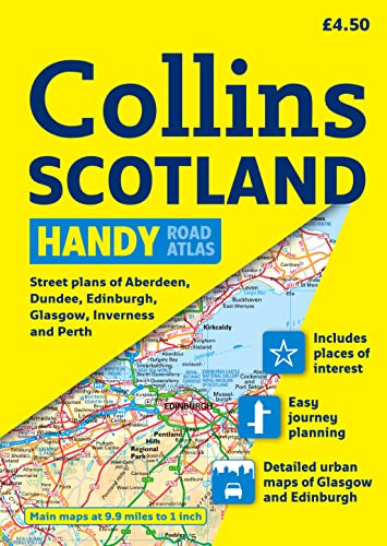

Scale of main maps: 1:625,000 (9.9 miles to 1 inch).
The handy A5 format and inclusion of a range of city plans make this the ideal companion for travelling around Scotland.
New for 2009:
2 extra city centre maps with indexes
Information on ferries and airports
MAIN FEATURES
Clear, attractive route planning maps of the whole of Scotland supported by comprehensive, fully indexed city centre street maps of Aberdeen, Dundee, Edinburgh, Glasgow, Inverness and Perth.
INCLUDES
� Places of tourist interest are highlighted.
� Has attractive layer colouring showing land height.
� Road network fully classified and colour coded.
� Detailed street mapping of Edinburgh, including the Royal Mile with all its attractions clearly marked, Leith and Holyrood Park.
� Detailed street mapping of Glasgow including the West End.
� Detailed street mapping of Aberdeen.
� Street maps, with indexes, of Dundee, Inverness and Perth city centres.
� Tranport connections section listing all the airports and details of all vehicle ferries into and within Scotland.
AREA OF COVERAGE
Covers the whole of Scotland and part of northern England, extending down to Kendal and Scarborough in the south.
WHO THE PRODUCT IS OF INTEREST TO
This atlas has a wealth of detail with road maps, urban area maps and a city centre street map section. Ideal for anyone travelling around Scotland who requires a ‘Handy’ format.
"synopsis" may belong to another edition of this title.
Product Description:
Scale of main maps: 1:625,000 (9.9 miles to 1 inch). The handy A5 format and inclusion of a range of city plans make this the ideal companion for travelling around Scotland. New for 2009: 2 extra city centre maps with indexes Information on ferries and airports
"About this title" may belong to another edition of this title.
- PublisherCollins
- Publication date2009
- ISBN 10 000725461X
- ISBN 13 9780007254613
- BindingPaperback
- Number of pages72
- Rating
Top Search Results from the AbeBooks Marketplace

Stock Image
Handy Road Atlas Scotland
Published by
HarperCollins Publishers Limited
(2010)
ISBN 10: 000725461X
ISBN 13: 9780007254613
Used
Softcover
Quantity: 1
Seller:
Rating
Book Description Condition: Good. Ships from the UK. Former library book; may include library markings. Used book that is in clean, average condition without any missing pages. Seller Inventory # 10986549-6
Buy Used
� 3.78
Convert currency
Stock Image
Handy Road Atlas Scotland
Published by
HarperCollins Publishers Limited
(2010)
ISBN 10: 000725461X
ISBN 13: 9780007254613
Used
Softcover
Quantity: 1
Seller:
Rating
Book Description Condition: Very Good. Ships from the UK. Used book that is in excellent condition. May show signs of wear or have minor defects. Seller Inventory # 40609320-20
Buy Used
� 3.78
Convert currency
Stock Image
Handy Road Atlas Scotland
Published by
HarperCollins UK
(2010)
ISBN 10: 000725461X
ISBN 13: 9780007254613
Used
Softcover
Quantity: 1
Seller:
Rating
Book Description Condition: Muy bueno. : Scale of main maps: 1:625,000 (9.9 miles to 1 inch).The handy A5 format and inclusion of a range of city plans make this the ideal companion for travelling around Scotland.New for 2009:2 extra city centre maps with indexesInformation on ferries and airportsMAIN FEATURESClear, attractive route planning maps of the whole of Scotland supported by comprehensive, fully indexed city centre street maps of Aberdeen, Dundee, Edinburgh, Glasgow, Inverness and Perth.INCLUDES? Places of tourist interest are highlighted.? Has attractive layer colouring showing land height.? Road network fully classified and colour coded.? Detailed street mapping of Edinburgh, including the Royal Mile with all its attractions clearly marked, Leith and Holyrood Park.? Detailed street mapping of Glasgow including the West End.? Detailed street mapping of Aberdeen.? Street maps, with indexes, of Dundee, Inverness and Perth city centres.? Tranport connections section listing all the airports and details of all vehicle ferries into and within Scotland.AREA OF COVERAGECovers the whole of Scotland and part of northern England, extending down to Kendal and Scarborough in the south.WHO THE PRODUCT IS OF INTEREST TOThis atlas has a wealth of detail with road maps, urban area maps and a city centre street map section. Ideal for anyone travelling around Scotland who requires a ?Handy? format. NOTA: El libro no est� en espa�ol, sino en ingl�s. EAN: 9780007254613 Tipo: Libros T�tulo: Handy Road Atlas Scotland Autor: Collins UK Editorial: HarperCollins Publishers Limited Formato: Libro de bolsillo. Seller Inventory # Happ-2024-04-17-08782e34
Buy Used
� 8.41
Convert currency