Items related to Greater London Street Atlas

Covers over 15,000 square miles of Central and Greater London Details railway and underground stations and car parks Index to over 75,000 streets
"synopsis" may belong to another edition of this title.
Synopsis:
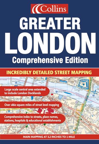
1:10,000 Central area, 1:20,000 Main area, 1:50,000 Urban maps, 1:162,600 Route Planning maps. Incredibly detailed street level mapping, with over 40 categories of information, covering 1660 square miles in and around London. MAIN FEATURES This is the ultimate street atlas of London. It contains a huge amount of detail and exhibits a high level of clarity, with land use clearly colour coded to aid use. This edition has an extended area at the extra large scale of 6.4 miles to 1 inch. The atlas has been fully revised, thousands of updates have been made to the mapping involving extensive and exhaustive research on the ground. Thousands of updates in this revised edition / Large area of central London at 6.4 inches to 1 mile / Area of over 4,300 square km (1660 sq miles) covered by main street mapping / Mapping at four main scales ranging from route planning maps to large scale central area maps INCLUDES / London connections rail map / London underground map / Theatres, cinemas, shopping and underground maps / Full index to street names and places of interest / Colour coded roads, buildings and land use AREA OF COVERAGE Extends from Welwyn Garden City in the north to Gatwick Airport in the south and from Windsor in the west to Gravesend in the east.WHO THE PRODUCT IS OF INTEREST TO This is the definitive reference atlas for London and the surrounding area. OTHER PRODUCTS IN THE SERIES This product can also be purchased as a hardback edition.
From the Back Cover:
1:10,000 Central area, 1:20,000 Main area, 1:20,000 Main area, 1:50,000 Urban maps, 1:125,000 Route Planning maps.
This has the greatest area of coverage of any London atlas.
MAIN FEATURES
� Thousands of updates in this revised edition
� Largest area of coverage of any London Street Atlas
� Durable hardback binding in A4 format
� Area of over 4,300 km2 covered by main street mapping
� Mapping at four main scales ranging from route planning maps to large scale central area maps
INCLUDES
� Theatres, cinemas, shopping and underground maps
� Full index to street names and places of interest
� M25 mileage charts
� Colour coded roads, buildings and land use
Extends form Welwyn Garden City in the north to Gatwick Airport in the south and from Windsor in the west to Gravesend in the east.
This is the definitive reference atlas for London and the surrounding area presented in a durable hardback binding.
"About this title" may belong to another edition of this title.
- PublisherCollins
- Publication date2005
- ISBN 10 0007181558
- ISBN 13 9780007181551
- BindingPaperback
- Number of pages464
Top Search Results from the AbeBooks Marketplace

Stock Image
Greater London Street Atlas
Published by
Harper Collins
(2005)
ISBN 10: 0007181558
ISBN 13: 9780007181551
Used
Paperback
Quantity: 1
Seller:
Rating
Book Description Paperback. Condition: Very Good. The book has been read, but is in excellent condition. Pages are intact and not marred by notes or highlighting. The spine remains undamaged. Seller Inventory # GOR001722464
Buy Used
� 25.20
Convert currency
Seller Image
Greater London Street Atlas
Seller:
Rating
Book Description Condition: Good. Most items will be dispatched the same or the next working day. Seller Inventory # wbb0024638260
Buy Used
� 25.21
Convert currency