Items related to Iraq, Kuwait and The Gulf
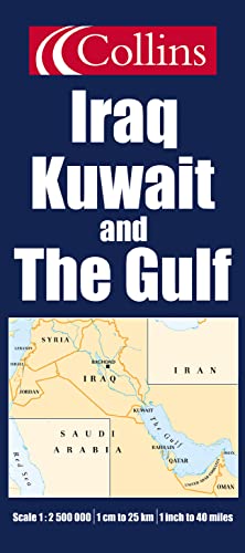

Brand new map of this politically volatile area of the Middle East. Scale 1:2 500 000; 1 cm to 25 km; 1 inch to 40 miles. With comprehensive index.
AREA OF COVERAGE
The map extends from the Iraqi/Turkish border in the north to the United Arab Emirates in the south and from the Mediterranean Sea and Israel in the west to Oman and the Strait of Hormuz in the east, and covers all of Iraq, Kuwait and The Gulf, Syria, Lebanon and Israel.
MAIN FEATURES
An attractive physical map of the region showing roads, railways, cities and towns, rivers, lakes and deserts. Highland and lowland is shown by colourful layer colouring.
INCLUDES
Inset map of the whole of the Middle East region at a scale of approximately 1:10 000 000
Comprehensive index to all names appearing on the Iraq, Kuwait & The Gulf map. Index uses simple alpha-numeric referencing system and is printed on the same side of the sheet for ease of use.
WHO THE PRODUCT IS AIMED AT
Armchair traveller and for home and business reference
"synopsis" may belong to another edition of this title.
From the Back Cover:
Synopsis:
AREA OF COVERAGE
The map extends from the Iraqi/Turkish border in the north to the United Arab Emirates in the south and from the Mediterranean Sea and Israel in the west to Oman and the Strait of Hormuz in the east, and covers all of Iraq, Kuwait and The Gulf, Syria, Lebanon and Israel.
MAIN FEATURES
An attractive physical map of the region showing roads, railways, cities and towns, rivers, lakes and deserts. Highland and lowland is shown by colourful layer colouring.
INCLUDES
Inset map of the whole of the Middle East region at a scale of approximately 1:10 000 000
Comprehensive index to all names appearing on the Iraq, Kuwait & The Gulf map. Index uses simple alpha-numeric referencing system and is printed on the same side of the sheet for ease of use.
Armchair traveller and for home and business reference
This map extends from the Iraqi/Turkish border in the north to the United Arab Emirates in the south and from the Mediterranean Sea and Israel in the west to Oman and the Strait of Hormuz in the east, and covers all of Iraq, Kuwait and The Gulf, Syria, Lebanon and Israel. It is a physical map of the region, showing roads, railways, cities and towns, rivers, lakes and deserts. Highland and lowland is shown by colourful layer colouring. It includes an inset map of the whole of the Middle East region at a scale of approximately 1:10000000 and a comprehensive index to all names appearing on the map, which uses a simple alpha-numeric referencing system and is printed on the same side of the sheet for ease of use.
"About this title" may belong to another edition of this title.
- PublisherCollins
- Publication date2003
- ISBN 10 0007170254
- ISBN 13 9780007170258
- BindingMap
(No Available Copies)
Search Books: Create a WantIf you know the book but cannot find it on AbeBooks, we can automatically search for it on your behalf as new inventory is added. If it is added to AbeBooks by one of our member booksellers, we will notify you!
Create a Want