Items related to Greater London Street Atlas

1:10,000 Central area, 1:20,000 Main area, 1:50,000 Urban maps, 1:162,600 Route Planning maps.
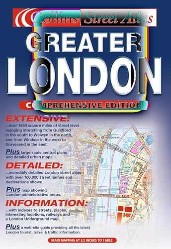
MAIN FEATURES
� Thousands of updates in this revised edition
� Largest area of coverage of any London Street Atlas
� Durable hardback binding in A4 format
� Area of over 4,300 km� covered by main street mapping
� Mapping at four main scales ranging from route planning maps to large scale central area maps
INCLUDES
� Theatres, cinemas, shopping and underground maps
� Full index to street names and places of interest
� M25 mileage chart
� Colour coded roads, buildings and land use
AREA OF COVERAGE
Extends from Welwyn Garden City in the north to Gatwick Airport in the south and from Windsor in the west to Gravesend in the east.
WHO THE PRODUCT IS AIMED AT
This is the definitive reference atlas for London and the surrounding area presented in a durable hardback binding.
OTHER PRODUCTS IN THE SERIES
This product can also be purchased as a paperback edition:
0 00 449061 4.
"synopsis" may belong to another edition of this title.
Synopsis:
1:10,000 Central area, 1:20,000 Main area, 1:50,000 Urban maps, 1:162,600 Route Planning maps This has the greatest area of coverage of any London atlas. MAIN FEATURES * Thousands of updates in this revised edition * Largest area of coverage of any London Street Atlas * Durable hardback binding in A4 format * Area of over 4,300 km covered by main street mapping * Mapping at four main scales ranging from route planning maps to large scale central area maps INCLUDES * Theatres, cinemas, shopping and underground maps * Full index to street names and places of interest * M25 mileage chart * Colour coded roads, buildings and land use AREA OF COVERAGE Extends from Welwyn Garden City in the north to Gatwick Airport in the south and from Windsor in the west to Gravesend in the east. WHO THE PRODUCT IS AIMED AT This is the definitive reference atlas for London and the surrounding area presented in a durable hardback binding. OTHER PRODUCTS IN THE SERIES This product can also be purchased as a paperback edition: 0 00 449061 4.
From the Back Cover:
1:10,000 Central area, 1:20,000 Main area, 1:20,000 Main area, 1:50,000 Urban maps, 1:125,000 Route Planning maps.
This has the greatest area of coverage of any London atlas.
MAIN FEATURES
� Thousands of updates in this revised edition
� Largest area of coverage of any London Street Atlas
� Durable hardback binding in A4 format
� Area of over 4,300 km2 covered by main street mapping
� Mapping at four main scales ranging from route planning maps to large scale central area maps
INCLUDES
� Theatres, cinemas, shopping and underground maps
� Full index to street names and places of interest
� M25 mileage charts
� Colour coded roads, buildings and land use
Extends form Welwyn Garden City in the north to Gatwick Airport in the south and from Windsor in the west to Gravesend in the east.
This is the definitive reference atlas for London and the surrounding area presented in a durable hardback binding.
"About this title" may belong to another edition of this title.
- PublisherCollins
- Publication date2000
- ISBN 10 0004490622
- ISBN 13 9780004490625
- BindingHardcover
- Number of pages432
Top Search Results from the AbeBooks Marketplace

Stock Image
Collins Greater London Street Atlas.
Published by
Collins, London
(2000)
ISBN 10: 0004490622
ISBN 13: 9780004490625
Used
Hardcover
Quantity: 1
Seller:
Rating
Book Description Hard cover. Condition: Fine. New ed. 432p. : all col. maps; 30 cm. Previous ed. : 1998. Seller Inventory # Alibris.0017644
Buy Used
� 32.76
Convert currency
Seller Image
Greater London Street Atlas
Seller:
Rating
Book Description Condition: VeryGood. Most items will be dispatched the same or the next working day. Seller Inventory # wbs9044932809
Buy Used
� 66.39
Convert currency