Items related to Road Map Great Britain and Ireland: Sheet 1 –...

1:250,000 4 miles to 1 inch. The southern sheet of a 6 sheet series of the British Isles. The mapping is extremely detailed and has attractive layer colouring. Updated for 2001.
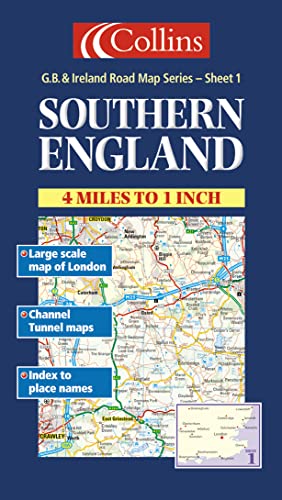
MAIN FEATURES
� Exceptionally clear Collins mapping with layer colouring
� Extremely attractive and easy to read mapping
� All roads colour classified
� Large scale map of Central London on reverse
� Channel Tunnel Map
INCLUDES
� Places of tourist information included
� Ferry routes & airports shown
� Distances shown on roads
� Full index to place names
AREA OF COVERAGE
Extends to Gloucester and Swindon in the west, Peterborough and Leicester in the north, to the coast in the east and south.
WHO THE PRODUCT IS AIMED AT
This map is ideal for wall mounting or for use in the vehicle and is suitable for both business or pleasure motoring.
"synopsis" may belong to another edition of this title.
From the Back Cover:
MAIN FEATURES
�
Exceptionally clear Collins mapping with layer colouring
�
Extremely attractive and easy to read mapping
�
All roads colour classified
�
Large scale map of Central London on reverse
�
Channel Tunnel Map
INCLUDES
�
Places of tourist information included
�
Ferry routes & airports shown
�
Distances shown on roads
�
Full index to place names
AREA OF COVERAGE
Extends to Gloucester and Swindon in the west, Peterborough and Leicester in the north, to the coast in the east and south.
WHO THE PRODUCT IS AIMED AT
This map is ideal for wall mounting or for use in the vehicle and is suitable for both business or pleasure motoring.
"About this title" may belong to another edition of this title.
- PublisherCollins
- Publication date2000
- ISBN 10 0004489799
- ISBN 13 9780004489797
- BindingMap
Top Search Results from the AbeBooks Marketplace

Seller Image
Road Map Great Britain and Ireland: Sheet 1 � Southern England (Great Britain and Ireland Road Map)
Seller:
Rating
Book Description Condition: VeryGood. Most items will be dispatched the same or the next working day. A copy that has been read, but is in excellent condition. Pages are intact and not marred by notes or highlighting. The spine remains undamaged. Seller Inventory # wbs6833045248
Buy Used
� 1.18
Convert currency