
Order Total (1 Item Items):
Shipping Destination:

9780008104566 - London Pocket Map by Collins Maps (4 results)
Skip to main search results
Product Type
- All Product Types
- Books (4)
- Magazines & Periodicals
- Comics
- Sheet Music
- Art, Prints & Posters
- Photographs
- Maps
-
Manuscripts &
Paper Collectibles
Condition
- All Conditions
- New
- Used
Binding
- All Bindings
- Hardcover
- Softcover (1)
Collectible Attributes
- First Edition
- Signed
- Dust Jacket
- Seller-Supplied Images
- Not Printed On Demand
Free Shipping
Seller Location
Seller Rating
-
Map. Condition: Used; Good. **SHIPPED FROM UK** We believe you will be completely satisfied with our quick and reliable service. All orders are dispatched as swiftly as possible! Buy with confidence! Greener Books.
-
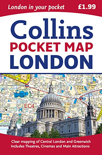
London Pocket Map
Published by HarperCollins Publishers, United Kingdom, London, 2015
ISBN 10: 0008104565ISBN 13: 9780008104566
Book
Paperback. Condition: Very Good. Handy little full colour map of central London with a high level of detail. Clear mapping of central London from Regents Park in the north to Kennington in the south, and Kensington Gardens in the west to Tower Bridge in the east at a scale of 1:12,500 (5 inches to 1 mile). Maps of West End shopping and theatres are also included. Clear, detailed, full colour mapping is presented in a handy format ideal for the pocket or handbag. It is excellent value at only 1.99 and covers the most visited area of central London. It is an essential buy for tourists and residents alike. INCLUDES Detailed central area map Theatres and cinemas map Shopping map Underground map The latest congestion zone boundary. The book has been read, but is in excellent condition. Pages are intact and not marred by notes or highlighting. The spine remains undamaged.
-
Collins Pocket Map London
Published by HarperCollins UK, 1856
ISBN 10: 0008104565ISBN 13: 9780008104566
Book
Condition: Sehr gut. 0 Gepflegter, sauberer Zustand. 25092166/2 Altersfreigabe FSK ab 0 Jahre Landkarte, Gr��e: 8.9 x 0.8 x 14 cm.
-
Collins Pocket Map London
Published by HarperCollins UK, 1856
ISBN 10: 0008104565ISBN 13: 9780008104566
Book
Condition: Gut. 0 Gebrauchs- und Lagerspuren. Au�en: Knick. 25092166/3 Altersfreigabe FSK ab 0 Jahre Landkarte, Gr��e: 8.9 x 0.8 x 14 cm.