Order Total (1 Item Items):
Shipping Destination:

J Blaeu (246 results)
Skip to main search results
Product Type
- All Product Types
- Books (160)
- Magazines & Periodicals
- Comics
- Sheet Music (1)
- Art, Prints & Posters (19)
- Photographs
- Maps (66)
-
Manuscripts &
Paper Collectibles
Condition
Binding
Collectible Attributes
Free Shipping
Seller Location
Seller Rating
-

Deutschland vor drei Jahrhunderten. Seine St�dte, Fl�sse u. W�lder betrachtet. M. e. nachw. v. C. Broekema.
Published by (G�tersloh) Bertelsmann (), 1971
4�. M. zahlr. Ktn u. Abb. 300 S. OPp. m. OPp.-Schuber. Sprache: Deutsch.
-
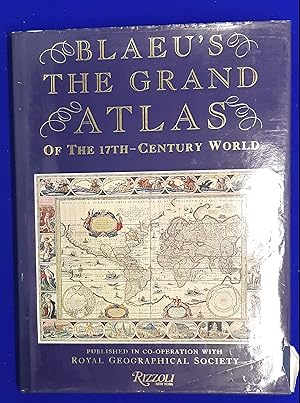
Blaeu's The Grand Atlas of the 17th Century World.
Published by Studio Editions, London, first edition, 1997, 1997
ISBN 10: 1858915880ISBN 13: 9781858915883
Book
Cloth, folio, 37 cm, 224 pp, 100 colour maps. Introduction by John Goss; foreword by Peter Clark. From the blurb: "Joan Blaeu's The Atlas Major, first published in 1662, is still the largest atlas ever produced. Over six hundred maps portray the world as it was known in the middle of the 17th century with its great empires, far-off exotic kingdoms and lands of legend. The embellishment and decoration of these maps, unsurpassed in their beauty and sumptuous detail, bring to life a long-lost age of mapmaking. The Atlas Major was the most expensive book sold in the 17th century. Published in an original edition of about three hundred copies, the atlas was not only functional, but it was also the great showpiece of the Amsterdam mapmaker's art. Copies were presented to kings and emperors (the French edition was dedicated to Louis XIV, The Sun King, and his finance minister, Colbert) and were bought by wealthy noblemen and merchants to display at home and impress their rivals." Near Fine in slightly chipped dustwrapper.
-
![Seller image for Horti medici amstelodamensis rariorum tam Orientalis ?qua?m Occidentalis India, aliarumque peregrinarum plantarum, magno studio ac labore, sumptibus Civitatis amstelodamensis, longa? annorum serie collectarum, descriptio et icones ad vivum ari incisa /auctore Joanne Commelino. Opus posthumum, latinitate donatum, notisque & observationibus illustratum, a? Frederico Ruyschio & Francisco Kiggelario. Volume 2 [LeatherBound] for sale by True World of Books](https://pictures.abebooks.com/inventory/md/md31532895781.jpg)
Horti medici amstelodamensis rariorum tam Orientalis ?qua?m Occidentalis India, aliarumque peregrinarum plantarum, magno studio ac labore, sumptibus Civitatis amstelodamensis, longa? annorum serie collectarum, descriptio et icones ad vivum ari incisa /auctore Joanne Commelino. Opus posthumum, latinitate donatum, notisque & observationibus illustratum, a? Frederico Ruyschio & Francisco Kiggelario. Volume 2 [LeatherBound]
Publication Date: 2023
Book Print on Demand
LeatherBound. Condition: New. LeatherBound edition. Condition: New. Reprinted from 1697 edition. Leather Binding on Spine and Corners with Golden leaf printing on spine. Bound in genuine leather with Satin ribbon page markers and Spine with raised gilt bands. A perfect gift for your loved ones. NO changes have been made to the original text. This is NOT a retyped or an ocr'd reprint. Illustrations, Index, if any, are included in black and white. Each page is checked manually before printing. As this print on demand book is reprinted from a very old book, there could be some missing or flawed pages, but we always try to make the book as complete as possible. Fold-outs, if any, are not part of the book. If the original book was published in multiple volumes then this reprint is of only one volume, not the whole set. Sewing binding for longer life, where the book block is actually sewn (smythe sewn/section sewn) with thread before binding which results in a more durable type of binding. Pages: 328 Volume 2 Language: Latin.
-
![Seller image for Horti medici amstelodamensis rariorum tam Orientalis ?qua?m Occidentalis India, aliarumque peregrinarum plantarum, magno studio ac labore, sumptibus Civitatis amstelodamensis, longa? annorum serie collectarum, descriptio et icones ad vivum ari incisa /auctore Joanne Commelino. Opus posthumum, latinitate donatum, notisque & observationibus illustratum, a? Frederico Ruyschio & Francisco Kiggelario. Volume 1 [LeatherBound] for sale by True World of Books](https://pictures.abebooks.com/inventory/md/md31532894861.jpg)
Horti medici amstelodamensis rariorum tam Orientalis ?qua?m Occidentalis India, aliarumque peregrinarum plantarum, magno studio ac labore, sumptibus Civitatis amstelodamensis, longa? annorum serie collectarum, descriptio et icones ad vivum ari incisa /auctore Joanne Commelino. Opus posthumum, latinitate donatum, notisque & observationibus illustratum, a? Frederico Ruyschio & Francisco Kiggelario. Volume 1 [LeatherBound]
Publication Date: 2023
Book Print on Demand
LeatherBound. Condition: New. LeatherBound edition. Condition: New. Reprinted from 1697 edition. Leather Binding on Spine and Corners with Golden leaf printing on spine. Bound in genuine leather with Satin ribbon page markers and Spine with raised gilt bands. A perfect gift for your loved ones. NO changes have been made to the original text. This is NOT a retyped or an ocr'd reprint. Illustrations, Index, if any, are included in black and white. Each page is checked manually before printing. As this print on demand book is reprinted from a very old book, there could be some missing or flawed pages, but we always try to make the book as complete as possible. Fold-outs, if any, are not part of the book. If the original book was published in multiple volumes then this reprint is of only one volume, not the whole set. Sewing binding for longer life, where the book block is actually sewn (smythe sewn/section sewn) with thread before binding which results in a more durable type of binding. Pages: 344 Volume 1 Language: Latin.
-
Blaeu's The Grand Atlas of the 17th Century World.
Published by Rizzoli, New York, first US edition, 1991, 1991
ISBN 10: 0847813002ISBN 13: 9780847813001
Book
Cloth, folio, 37 cm, 224 pp, 100 colour maps. Introduction by John Goss; foreword by Peter Clark. From the blurb: "Joan Blaeu's The Atlas Major, first published in 1662 was and remains the largest alias ever published. Its six hundred or so maps portray the world as it was known in the middle of the seventeenth century with its great empires, far off kingdoms and lands of legend. The embellishment and decoration of these maps, unsurpassed in their beauty and detail, belonged to a long lost age of map-making. At the time it was published The Atlas Major was a functional atlas, but it was also the great show piece of the Amsterdam mapmaker's art. It is believed that it was published in an edition of three hundred copies, which were presented to kings and emperors and bought by wealthy noblemen and merchants to display in their houses and impress their rivals. The French edition was dedicated to Louis XIV, The Sun King, and his finance minister, Colbert, and the Atlas was the most expensive book sold in the course of the seventeenth century. Several copies still survive and command prices at auction well out of the reach of all but the wealthiest collector. This edition contains one hundred of the most important maps reproduced using the finest modern techniques from the volume held in the map room of the Royal Geographical Society in London, John Goss, formerly the cartographic consultant at Sotheby's, has written the introduction which outlines the history of the Atlas, together with caption notes for each of the maps chosen. Many of these include historical information relating to the contemporary history of the region shown. " Very Good in slightly torn dustwrapper.
-
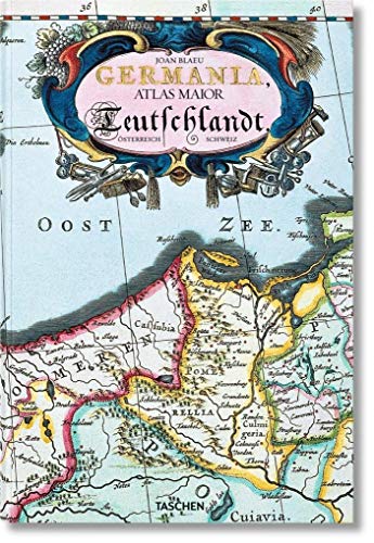
Germania : Atlas maior of 1665 ; 100 Tafeln mit Karten von Germanien, �sterreich und der Schweiz, sowie Originaltexte von Joan Blaeu aus seinem Atlas Major von 1665, "dem gr�ssten und prachtvollsten Atlas, der jemals ver�ffentlicht wurde" ; nach dem Original aus der �sterreichischen Nationalbibliothek, Wien = Deutschland / Joan Blaeu ; Einf�hrung und Texte von Peter van der Krogt ; directed and produced by Benedikt Taschen
Published by K�ln : Taschen, 2015
ISBN 10: 3836522926ISBN 13: 9783836522922
Book
Broschur, 25,5 x 38 cm. Condition: Gut. 4. 1 Atlas (235 Seiten) ; 39 cm Gebraucht; gut. Leichte Gebrauchsspuren. 200737556 Sprache: Deutsch Gewicht in Gramm: 1600.
-
Hardcover. Condition: Near Fine. Dust Jacket Condition: Very Good. atlas folio, 100 maps, orig blue cloth , fine copy in only little edge rubbed vg dw. heavy book extra postage will be requested. Book.
-
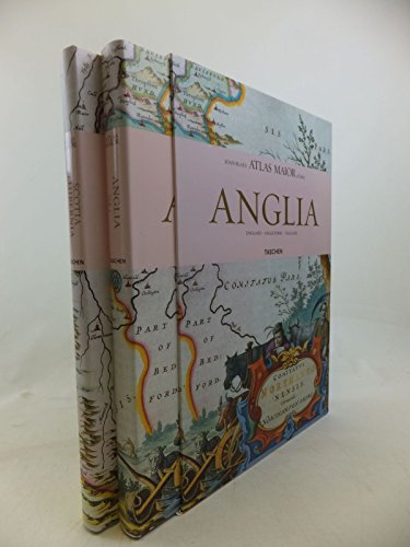
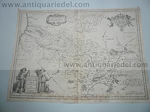
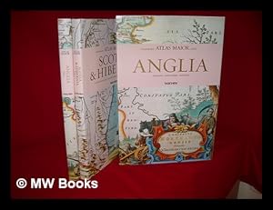
Atlas Maior of 1665: Anglia & Scotia & Hibernia (Two Volumes)
Published by Taschen, Koln, 2006
ISBN 10: 3822851043ISBN 13: 9783822851043
Book First Edition
hardcover. Profusely illustrated (illustrator). 1st edition. 4to, pp., Still shrink-wrapped from the publisher., Text in English, German and French. Fine copy in fine dust jacket & slipcase.
-
A Biography and history of his work as a cartographer and publisher. [Mit Schwarzwei� � -Abbildungen im Text.].
Publication Date: 1973
Seller: Riverow Bookshop, Owego, NY, U.S.A.
Seller Rating:

Condition: --/No Dustjacket. --/No Dustjacket. 1973. Theatrum Orbis Terrarum B. V., Amsterdam, 1973. Leinengepr� ¤gter Original- Pappband, XI, 164 Seiten, 8� ° .
-
Palais du Nonce a St. Francesco della Vigna a Venise.
Published by Amsterdam, Chez Pierre Mortier, 1704, 1704
Seller: TABERNA LIBRARIA - ALAI - ILAB, Pistoia, Italy
Seller Rating:

Acquaforte mm. 225x265 + piccoli marg. bianchi. Qualche lievissima sgualcitura al marg. sup.
-
Condition: Gut. Faksimiles nach der Prachtausgabe (der Novus Atlas, Das ist/ Weld-beschreibung/? Theil VI) der Herzog August Bibliothek Wolfenb�ttel mit Einf�hrung v. Y. A. Haase. M�ller u. Schindler, Stgt. 1974. Farb. Titelbl., 17 doppelseit. farb. Karten u. 17 Textbl. (Beiheft: 14 S. Kart.) lose in Mappe. Folio (50 x 34 cm). Hln. R�cken leicht fleckig. Karten an der Ecke besto�en. Schuber besch�d. / 16237 Mit Ausnahme von Direkt-Recycling Materialien erfolgt der Versand ohne Einsatz von Kunststoffen. Sprache: Deutsch.
-
Hardcover. Condition: very good. Picardia, map, Blaeu anno 1660 Coppermap, edited by G Blaeu, ca. anno 1660, no text on verso, size of the leaf: 40 x 55 cm., little waterstained, foxed.
-
Aardenburg-Ysendijck, Zeeland, Blaeu anno 1640, townbooks
Published by Blaeu W.+J.,Atlases,Maps,Townboo
Hardcover. Condition: very good. Aardenburg-Ysendijck, Zeeland, Blaeu anno 1640, townbooks, dutch lanquage on verso, size of the leaf: 43x62 cm.
-
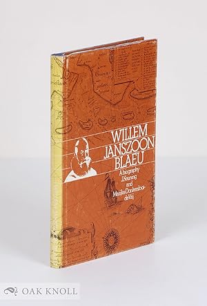
WILLEM JANSZOON BLAEU, A BIOGRAPHY AND HISTORY OF HIS WORK AS A CARTOGRAPHER
Published by Theatrum Orbis Terrarum, Amsterdam, 1973
Seller: Oak Knoll Books, ABAA, ILAB, NEW CASTLE, DE, U.S.A.
Seller Rating:
First Edition
cloth, dust jacket. Blaeu, Willem Janszoon (illustrator). 8vo. cloth, dust jacket. 164 pages. First edition. Spine of jacket faded and rubbed, else very good. Illustrated.
-

Atlas maior of 1665 / Joan Blaeu ; introduction and texts by Peter van der Krogt ; based on the copy in the Osterreichische Nationalbibliothek, Wien ; with a selection of original texts by Joan Blaeu ; directed and produced by Benedikt Taschen
Published by Hong Kong ; London : Taschen, 2006
First Edition
First Edition. Fine copy in the original gilt-blocked cloth boards in a slightly worn slip-case. Particularly and surprisingly well-preserved; tight, bright, clean and especially sharp-cornered. Physical description; 2 v. (392 p.) : ill. (chiefly col., col. maps, col. ports.) ; 39 cm. Notes; In slip case. "All 113 maps of England, Scotland and Ireland, and the original commentaries from Joan Blaeu's Atlas maior of 1665, 'the greatest and finest atlas ever published.'". Includes bibliographical references and index. Contents; Incomplete contents v. 1. Anglia = England -- v. 2. Scotia & Hibernia = Scotland and Ireland. Summary; This work contains maps of England, Ireland, and Scotland from Joan Blaeu's exquisite world atlas of 1665. "The Atlas Maior", the cartographical masterpiece of the Baroque period, was brought out between 1662 and 1665 by the Amsterdam publisher Joan Blaeu, one of Holland's leading cartographers. Originally appearing in Latin, the atlas comprised 594 maps in 11 volumes, which depicted the whole of the world as known to early modern Europe. It was the largest and most expensive book published during the 17th century. For more than 100 years, it remained the definitive atlas of the world, and today is among the most sought-after and valuable antiquarian rarities. This reprinted edition in six volumes is based on the hand-colored, gold-heightened copy in the "Osterreichische Nationalbibliothek" in Vienna, thus ensuring the best possible detail and quality. Alongside Joan Blaeu's original commentaries on the individual maps, a new text by Peter van der Krogt explains the historical and cultural associations and introduces the reader to the fascinating world of early modern cartography. This two-volume set features all 58 maps of England and 55 maps of Scotland and Ireland and the text is in English, French, and German. Subjects; Scales differ. England - Maps - Early works to 1800. Ireland - Maps - Early works to 1800. Scotland - Maps - Early works to 1800. Travel / road maps & atlases. Antiques & collectables: pictures, prints & maps. England ; Scotland ; Ireland. Reference / Atlases, Gazetteers & Maps. Technology & Engineering / Cartography. Technology & Engineering / History. 10 Kg.
-
![Stock image for Atlas Maior of 1665. Einf�hrung und Texte von P. van der Krogt. Mit einer Auswahl der Originaltexte von Joan Blaeu. Reprint der farb. Karten nach dem Original [Ausgabe Joan Blaeu, Amsterdam 1665] aus der �sterr. Nationalbibliothek, Wien. for sale by M�ller & Gr�ff e.K.](https://pictures.abebooks.com/isbn/9783836524117-uk-300.jpg)
Atlas Maior of 1665. Einf�hrung und Texte von P. van der Krogt. Mit einer Auswahl der Originaltexte von Joan Blaeu. Reprint der farb. Karten nach dem Original [Ausgabe Joan Blaeu, Amsterdam 1665] aus der �sterr. Nationalbibliothek, Wien.
Published by K�ln Taschen ( ), 2010
ISBN 10: 3836524112ISBN 13: 9783836524117
Book
Gr.4�. 512 S. Mit zahlr. farb. Karten. Original-Pappband mit Schutzumschlag. im Orig.-Schuber. "Der gr��te und prachtvollste Atlas, der jemals ver�ffentlicht wurde". - Text dreisprachig (englisch, franz�sisch und deutsch). - Gutes Exemplar. Gewicht (Gramm): 4960.
-
Bituricum ducatus, Duche de Berri, map, 1640, Blaeu J.
Published by Blaeu W.+J.,Atlases,Maps,Townboo
Hardcover. Condition: very good. Bituricum ducatus, Duche de Berri, map, 1640, Blaeu J. Coppermap, edited by the Blaeu Family, anno 1640, german text on verso, size of the leaf: 46x54 cm., no cracs, little brownish.
-
Hardcover. Condition: very good. Nivernois,ducatus,anno 1650, map, Blaeu Coppermap, edited by Blaeu Family, anno 1650, "NIVERNIVM DVCATVS. Gallice DVCHE DE NEVERS.", german text on verso, printed on thick paper, clean map, no cracs. size of the leaf: 46 x 54 cm.
-
Hardcover. Condition: very good. Coppermap, edited by Joan Blaeu, in his townbooks, anno 1649, size of the leaf: 49x62 cm., latin text on verso, restored crac on below margin (in the view).
-
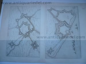
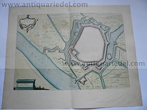
Hardcover. Condition: very good. B�derich (BVRICK)-Wesel, anno 1700, Grundriss, Blaeu, Grundriss der Stadt, Blattma�: 50x30 cm., Plan: 34x23 cm. Referenz: Fauser, Nr. 2126, lat. R�ckentext. B�derich ist seit 1975 ein Ortsteil der Stadt Wesel, der zusammen mit dem Ortsteil Ginderich den Stadtteil B�derich mit seinen 6.227 Einwohnern (30. Juni 2006) bildet.
-
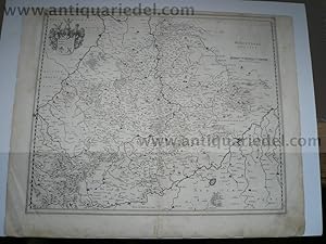
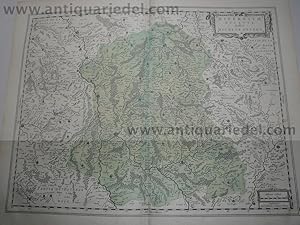
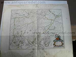
Hardcover. Condition: very good. Wirtenberg Ducatus, anno 1640, Blaeu, Karte Wirtenberg Ducatus. Blattma�: 46x58 cm., W�rttemberg mit angrenzenden Gebieten zwischen Heidelberg, Schw�bisch Hall, Lauingen / Donau, Memmingen, Villingen / Schwarzwald, Freiburg und dem Rhein von Stra�burg bis Mannheim, mit Stuttgart im Zentrum der Karte. Etwas fingerfleckig, kleinere Randl�suren, an den R�ndern kleinere Reparaturen.
-
Stift Hirschfeld, anno 1650, Blaeu, altkoloriert, dt. R�ckentext
Published by Blaeu W.+J.,Atlases,Maps,Townboo
Hardcover. Condition: very good. Stift Hirschfeld, anno 1650, Blaeu, altkoloriert, franz. R�ckentext Kupferkarte, verlegt bei Blaeu, Amsterdam, anno 1650, Blattma�: 49x60 cm., Mittelfalz etwas geknittert; ansonsten guter Erhaltungszustand, breitrandig.
-
Hardcover. Condition: very good. Anjou, anno 1640, Blaeu map Coppermap, edited by the Blaeu family, anno 1640, german text on verso, little waterstained, size of the leaf: 46x54 cm.
-
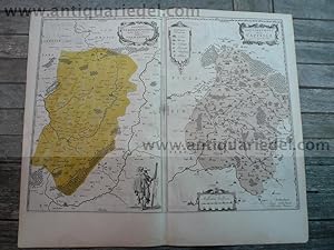
Hardcover. Condition: very good. Vermandois/Capelle, 2 maps, Blaeu anno 1640 Title: Descriptio Veromanduorum . . . Gallice Vermandois [and] Gouvernement de la Cappelle . . . Map Maker: Willem Janszoon Blaeu Place / Date: Amsterdam / 1640 A nice pair of decorative regional maps on a single sheet. The Vermandois map is centered on the Oyse and Somme Rivers, and shows Chatelet, Beaurevoir, S. Quintin , Preone, Lafere, Channi and Noyon, amoung other larger towns in the region. The Cappelle map is centered on the Oyse and includes Vervins, La Cappelle, Aubanton and Marle, amoung others. Both with title carouches and additional embellishments. German lanquage on verso, size of the leaf: 46x54 cm., little waterstained, no cracs.
-
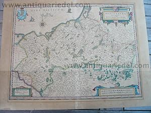
Hardcover. Condition: very good. Please read german textKupferkarte, verlegt bei G. Blaeu, anno 1650, dt. R�ckentext: "Das Hertzogthumb Meckelnburg" , alt koloriert, etwas gebr�unt, untere Mittelfalz alt hinterlegt, min. Randl�suren. Blattma�: 46x56 cm.
-
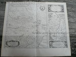
Hardcover. Condition: very good. Lemovicum-Limosin, Limaniae, anno 1650, Blaeu Willem Janszoon Blaeu: Lemovicum - Lymosin (and) Topographia Limaniae Acutore Gabriele Simeoneo. Size of the leaf: 46x54 cm., german text on verso, good print, no cracs. Decorative map of the Limosin and Limoge region, with decorative cartouches. Large inset of the Elaver River region.
-
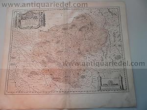
Bavaria Ducatus, anno 1665, Blaeu J., Atlas Major, altkoloriert,
Published by Blaeu W.+J.,Atlases,Maps,Townboo
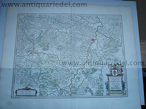
Hardcover. Condition: very good. Bavaria Ducatus, anno 1665, Blaeu J., Atlas Major, altkoloriert, span. R�ckentext, Blattma�: 64x52 cm. Das Blatt ist stark wasser-und sporenfleckig. Die detaillreiche Karte zeigt das Herzogtum Bayern, das Gebiet zwischen den Fl�ssen Lech, Donau, Inn-Salzach und Traun mit den Alpen im S�den. Die Karte wird begrenzt durch die Ortschaften F�ssen , Landsberg und Augsburg im Westen, Donauw�rth, Regensburg und Passau im Norden, Wels und Salzburg im Osten sowie Zell am See und Innsbruck im S�den. Rechts unten gro�e, dekorative Titelkartusche "Bavaria Ducatus / Per Ger. Mercatorem" , auf der Kartusche sitzende weibliche Figur mit bayrischem Wappen. Darunter Meilenanzeiger (Milliaria Bavarica). Links daneben Verlegerhinweis "Apud Guiljelmum Blaeu.".
-
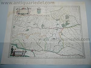
Hardcover. Condition: very good. Lionnois,map,Blaeu,anno 1650, old coloured Coppermap, edited by the Blaeu family, anno 1650: "LIONNOIS, FOREST, BEAUIOLOIS ET MASCONNOIS", Original coloured in outline. Oriented to the west on the top, wide margins, upper margin little waterstained, german text on verso, with the rivers Loire and Rhone. Size of the leaf: 45 x 54 cm., of the map: 38 x 50 cm.
-
Italia. atlas maior. (int).
Published by BENEDIKT TASCHEN VERLAG, 2006
ISBN 10: 3822851078ISBN 13: 9783822851074
Book
Condition: Muy Bueno / Very Good.