Corby, Kettering and Wellingborough: Sheet 224 (Explorer Maps)
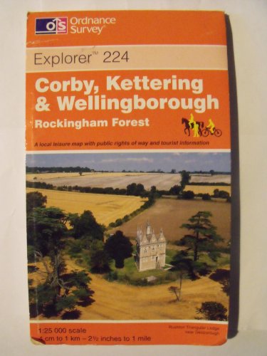
9780319218556: Corby, Kettering and Wellingborough: Sheet 224 (Explorer Maps)
View all copies of this ISBN edition:
 
 
This map is part of the Ordnance Survey's Explorer series designed to replace the old Pathfinder map series. At 1:25,000 scale this detailed map shows a host of attractions including gardens which are open to the public, nature reserves and country parks as well as all official footpaths, bridleways, roads and lanes. Other facilities covered include: camping and caravan sites, picnic areas and viewpoints, selected places of interest, rights of way information for England and Wales, National Trail and Recreational Path routes, and selected tourist information. The main advantages of this map are the geographical design of the sheetlines to capture the best local coverage, and the coverage of a larger area for value for money. The series is aimed mainly at the experienced map user but can be used by tourists and locals alike.

"synopsis" may belong to another edition of this title.

About the Author:
Ordnance Survey is Britain's national mapping agency, responsible for the official, definitive mapping of the whole country. They produce and market a wide range of maps for educational and leisure purposes, as well as producing computer data products for government, business and administrative use.

"About this title" may belong to another edition of this title.

  • PublisherOrdnance Survey
  • Publication date1999
  • ISBN 10 0319218554
  • ISBN 13 9780319218556
  • BindingMap

Buy Used

Condition: Fair
A readable copy of the book which... Learn more about this copy

Shipping: £ 4.80
From United Kingdom to U.S.A.

Destination, rates & speeds

Add to Basket

Top Search Results from the AbeBooks Marketplace

Stock Image

Ordnance Survey
ISBN 10: 0319218554 ISBN 13: 9780319218556
Used Paperback Quantity: 1
Seller:
WorldofBooks
(Goring-By-Sea, WS, United Kingdom)

Book Description Paperback. Condition: Fair. A readable copy of the book which may include some defects such as highlighting and notes. Cover and pages may be creased and show discolouration. Seller Inventory # GOR003987695

More information about this seller | Contact seller

Buy Used
£ 0.79
Convert currency

Add to Basket

Shipping: £ 4.80
From United Kingdom to U.S.A.
Destination, rates & speeds
Stock Image

Ordnance Survey
ISBN 10: 0319218554 ISBN 13: 9780319218556
Used Paperback Quantity: 3
Seller:
WorldofBooks
(Goring-By-Sea, WS, United Kingdom)

Book Description Paperback. Condition: Very Good. The book has been read, but is in excellent condition. Pages are intact and not marred by notes or highlighting. The spine remains undamaged. Seller Inventory # GOR002671583

More information about this seller | Contact seller

Buy Used
£ 0.79
Convert currency

Add to Basket

Shipping: £ 4.80
From United Kingdom to U.S.A.
Destination, rates & speeds
Seller Image

Ordnance Survey
Published by Ordnance Survey
ISBN 10: 0319218554 ISBN 13: 9780319218556
Used Quantity: 1
Seller:
WeBuyBooks
(Rossendale, LANCS, United Kingdom)

Book Description Condition: VeryGood. Most items will be dispatched the same or the next working day. Seller Inventory # wbs9457046569

More information about this seller | Contact seller

Buy Used
£ 0.79
Convert currency

Add to Basket

Shipping: £ 8
From United Kingdom to U.S.A.
Destination, rates & speeds
Stock Image

Ordnance Survey
Published by Ordnance Survey (1999)
ISBN 10: 0319218554 ISBN 13: 9780319218556
Used Quantity: 1
Seller:
Reuseabook
(Gloucester, GLOS, United Kingdom)

Book Description Map. Condition: Used; Good. Dispatched, from the UK, within 48 hours of ordering. This book is in good condition but will show signs of previous ownership. Please expect some creasing to the spine and/or minor damage to the cover. Damaged book. Slightly damaged in some way typically, a grazed corner or torn cover. Seller Inventory # CHL9469722

More information about this seller | Contact seller

Buy Used
£ 1.56
Convert currency

Add to Basket

Shipping: £ 7.37
From United Kingdom to U.S.A.
Destination, rates & speeds
Stock Image

Ordnance Survey
Published by Ordnance Survey (1999)
ISBN 10: 0319218554 ISBN 13: 9780319218556
Used Quantity: 1
Seller:
Reuseabook
(Gloucester, GLOS, United Kingdom)

Book Description Map. Condition: Used; Very Good. Dispatched, from the UK, within 48 hours of ordering. Though second-hand, the book is still in very good shape. Minimal signs of usage may include very minor creasing on the cover or on the spine. Seller Inventory # CHL9662153

More information about this seller | Contact seller

Buy Used
£ 1.56
Convert currency

Add to Basket

Shipping: £ 7.37
From United Kingdom to U.S.A.
Destination, rates & speeds
Stock Image

Ordnance Survey
ISBN 10: 0319218554 ISBN 13: 9780319218556
Used Quantity: 1
Seller:
MusicMagpie
(Stockport, United Kingdom)

Book Description Condition: Very Good. 1631898479. 1/1/0001 12:00:00 AM. Seller Inventory # U9780319218556

More information about this seller | Contact seller

Buy Used
£ 3.99
Convert currency

Add to Basket

Shipping: £ 5.49
From United Kingdom to U.S.A.
Destination, rates & speeds