2020 Collins Essential Road Atlas Britain and Northern Ireland - Softcover
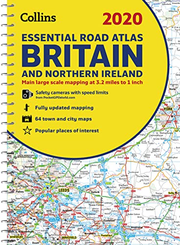

This A4 road atlas with popular lie-flat spiral binding features clear, detailed road mapping, at a scale of 3.2 miles to 1 inch (1:200,000) for England, Wales and Southern Scotland and at 4.2 miles to 1 inch (1:266,000) in Northern Scotland, and including Northern Ireland with land height shown by attractive layer colouring.
� Route planning section including maps at a scale of 22 miles to 1 inch for long distance route planning, motorway services information and a handy distance calculator chart
� 26 urban area approach maps at a larger scale which clearly show the best routes through and into the busiest built-up-areas
� 64 street maps focused on town centres showing places of interest, car park locations and one-way streets. All the street maps are fully indexed
� Fully updated fixed speed camera sites with average speed camera locations clearly highlighted. All speed cameras show the speed limit
� Over 30 categories of places of interest including castles, theme parks, sports venues, universities, mountain bike trails and surfing beaches
� The top 1000 most visited places of interest are indexed with full postcodes to aid integration with satnav systems
� Easy to use, clear road maps at a scale of 3.2 miles to 1 inch (1:200,000) for England, Wales, Southern Scotland, Northern Ireland and at 4.2 miles to 1 inch (1:266,000) in Northern Scotland
An ideal purchase for drivers, navigators and route planners who want the very best road atlas of Britain and Northern Ireland in an A4 format.
"synopsis" may belong to another edition of this title.
Review:
About the Author:
“The use of light colours in the maps and a 3.2mpi scale make the Collins Essential easy to read at a glance” Auto Express
Explore the world through accurate and up-to-date mapping.
"About this title" may belong to another edition of this title.
- PublisherCollins
- Publication date2019
- ISBN 10 0008318700
- ISBN 13 9780008318703
- BindingSpiral-bound
- Number of pages344
Top Search Results from the AbeBooks Marketplace

Seller Image
2020 Collins Essential Road Atlas Britain and Northern Ireland (Spiral Bound, Comb or Coil)
Published by
Collins Publishers 9/1/2019
(2019)
ISBN 10: 0008318700
ISBN 13: 9780008318703
New
Spiral Bound, Comb or Coil
Quantity: 5
Seller:
Rating
Book Description Spiral Bound, Comb or Coil. Condition: New. 2020 Collins Essential Road Atlas Britain and Northern Ireland 2.2. Book. Seller Inventory # BBS-9780008318703
Buy New
� 9.65
Convert currency
Stock Image
2020 Collins Essential Road Atlas Britain and Northern Ireland
Seller:
Rating
Book Description Condition: New. Book is in NEW condition. 2.2. Seller Inventory # 0008318700-2-1
Buy New
� 15.91
Convert currency
Stock Image
2020 Collins Essential Road Atlas Britain and Northern Ireland
Seller:
Rating
Book Description Condition: New. New! This book is in the same immaculate condition as when it was published 2.2. Seller Inventory # 353-0008318700-new
Buy New
� 15.92
Convert currency
Stock Image
2020 Collins Essential Road Atlas Britain and Northern Ireland
Seller:
Rating
Book Description Softcover. Condition: new. This A4 road atlas with popular lie-flat spiral binding features clear, detailed road mapping, at a scale of 3.2 miles to 1 inch (1:200,000) for England, Wales and Southern Scotland and at 4.2 miles to 1 inch (1:266,000) in Northern Scotland, and including Northern Ireland with land height shown by attractive layer coloring. Route planning section including maps at a scale of 22 miles to 1 inch for long distance route planning, motorway services information and a handy distance calculator chart 26 urban area approach maps at a larger scale which clearly show the best routes through and into the busiest built-up-areas 64 street maps focused on town centers showing places of interest, car park locations and one-way streets. All the street maps are fully indexed Fully updated fixed speed camera sites with average speed camera locations clearly highlighted. All speed cameras show the speed limit Over 30 categories of places of interest including castles, theme parks, sports venues, universities, mountain bike trails and surfing beaches. The top 1000 most visited places of interest are indexed with full postcodes to aid integration with satnav systems. Seller Inventory # DADAX0008318700
Buy New
� 15.94
Convert currency
Seller Image
2020 Collins Essential Road Atlas Britain and Northern Ireland by Collins Maps [Spiral-bound ]
Seller:
Rating
Book Description Soft Cover. Condition: new. Seller Inventory # 9780008318703
Buy New
� 17.64
Convert currency
Seller Image
2020 Collins Essential Road Atlas Britain and Northern Ireland (Spiral)
Published by
Harpercollins Publishers, London
(2019)
ISBN 10: 0008318700
ISBN 13: 9780008318703
New
Spiral
Quantity: 1
Seller:
Rating
Book Description Spiral. Condition: new. Spiral. This A4 road atlas with popular lie-flat spiral binding features clear, detailed road mapping, at a scale of 3.2 miles to 1 inch (1:200,000) for England, Wales and Southern Scotland and at 4.2 miles to 1 inch (1:266,000) in Northern Scotland, and including Northern Ireland with land height shown by attractive layer colouring. * Route planning section including maps at a scale of 22 miles to 1 inch for long distance route planning, motorway services information and a handy distance calculator chart * 26 urban area approach maps at a larger scale which clearly show the best routes through and into the busiest built-up-areas * 64 street maps focused on town centres showing places of interest, car park locations and one-way streets. All the street maps are fully indexed * Fully updated fixed speed camera sites with average speed camera locations clearly highlighted. All speed cameras show the speed limit * Over 30 categories of places of interest including castles, theme parks, sports venues, universities, mountain bike trails and surfing beaches * The top 1000 most visited places of interest are indexed with full postcodes to aid integration with satnav systems * Easy to use, clear road maps at a scale of 3.2 miles to 1 inch (1:200,000) for England, Wales, Southern Scotland, Northern Ireland and at 4.2 miles to 1 inch (1:266,000) in Northern Scotland An ideal purchase for drivers, navigators and route planners who want the very best road atlas of Britain and Northern Ireland in an A4 format. This A4 road atlas with popular lie-flat spiral binding features clear, detailed road mapping, at a scale of 3.2 miles to 1 inch (1:200,000) for England, Wales and Southern Scotland and at 4.2 miles to 1 inch (1:266,000) in Northern Scotland, and including Northern Ireland with land height shown by attractive layer colouring. Shipping may be from multiple locations in the US or from the UK, depending on stock availability. Seller Inventory # 9780008318703
Buy New
� 22.23
Convert currency
Stock Image
2020 Collins Essential Road Atlas Britain and Northern Ireland
Seller:
Rating
Book Description Condition: New. . Seller Inventory # 52GZZZ00FVKA_ns
Buy New
� 22.54
Convert currency
Stock Image
2020 Collins Essential Road Atlas Britain and Northern Ireland
Published by
HarperCollins Publishers
(2019)
ISBN 10: 0008318700
ISBN 13: 9780008318703
New
Softcover
Quantity: > 20
Seller:
Rating
Book Description Condition: New. 2019. New edition. Spiral-bound. . . . . . Seller Inventory # V9780008318703
Buy New
� 27.90
Convert currency
Stock Image
2020 Collins Essential Road Atlas Britain and Northern Ireland
Seller:
Rating
Book Description Spiral-bound. Condition: Brand New. new edition edition. 344 pages. 11.69x8.27x0.94 inches. In Stock. Seller Inventory # zk0008318700
Buy New
� 27.55
Convert currency
Stock Image
2020 Collins Essential Road Atlas Britain and Northern Ireland
Published by
HarperCollins Publishers
(2019)
ISBN 10: 0008318700
ISBN 13: 9780008318703
New
Softcover
Quantity: > 20
Seller:
Rating
Book Description Condition: New. 2019. New edition. Spiral-bound. . . . . . Books ship from the US and Ireland. Seller Inventory # V9780008318703
Buy New
� 32.79
Convert currency