The Times World Wall Laminated Map (The Times Atlases)
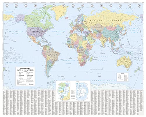

This laminated (front side only) Times Map of the World has been fully revised and updated to include the latest political changes. The map is politically coloured and shows individual countries and their capital city, major roads, railways and cities and towns.
Local name forms are used for all towns and cities with the English or historical alternative shown in brackets e.g. Mumbai (Bombay), Sankt Peterburg (Leningrad) where space permits. This makes the map readily accessible to the general reader who needs an up-to-date map to follow reports of world events in newspapers, on radio and television.
INCLUDES:
� All recent political changes carried out to mapping.
� Index to names on the map with cross references to alternative and historical name forms.
SIZE:
100 x 125 cm, 39.5 x 49 inches
AREA OF COVERAGE:
All of the world, centred on the Greenwich Meridian, and including maps of the North and South Pole regions.
SCALE:
Scale 1:25 000 000; 1 cm to 250 km; 1 inch to 395 miles.
"synopsis" may belong to another edition of this title.
About the Author:
Collins UKis a leading information-led publisher of illustrated and narrative nonfiction."
"About this title" may belong to another edition of this title.
- PublisherTimes Books
- Publication date2014
- ISBN 10 0007493126
- ISBN 13 9780007493128
- BindingPoster
- Number of pages1
(No Available Copies)
Search Books: Create a WantIf you know the book but cannot find it on AbeBooks, we can automatically search for it on your behalf as new inventory is added. If it is added to AbeBooks by one of our member booksellers, we will notify you!
Create a Want