Items related to The Oarsman's and Angler's Map of the River...
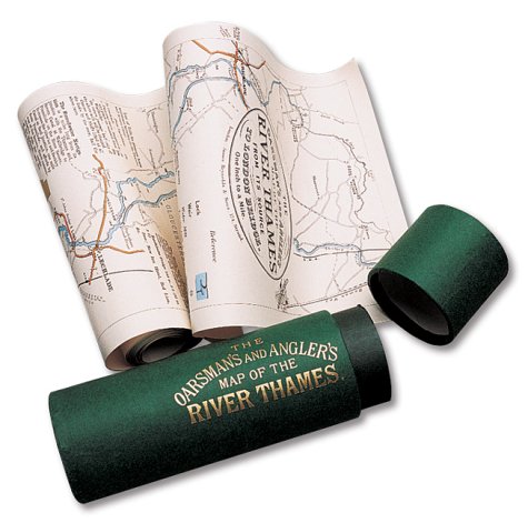

Explore Britain's best loved waterway with the map that must surely have been used by the Three Men in a Boat. Very detailed, one inch to the mile and over 8 feet in length, it shows all 164 miles from the source to London. Riverside towns and villages are marked with historical information and details of the locks and how to operate them. For fishermen, the best pools where trout, pike, perch and others were to be found. There are also details of toll charges and angling laws and a description of life on the river over a century ago when the Thames was the nation's favourite place for recreation and sport. The map is scrolled in a gold blocked presentation tube.
"synopsis" may belong to another edition of this title.
- PublisherOld House
- Publication date1991
- ISBN 10 1873590024
- ISBN 13 9781873590027
- BindingMap
- Number of pages1
(No Available Copies)
Search Books: Create a WantIf you know the book but cannot find it on AbeBooks, we can automatically search for it on your behalf as new inventory is added. If it is added to AbeBooks by one of our member booksellers, we will notify you!
Create a Want