Order Total (1 Item Items):
Shipping Destination:

Sohr (372 results)
Skip to main search results
Product Type
- All Product Types
- Books (226)
- Magazines & Periodicals
- Comics
- Sheet Music
- Art, Prints & Posters (4)
- Photographs
- Maps (139)
-
Manuscripts &
Paper Collectibles (3)
Condition
Binding
Collectible Attributes
Free Shipping
Seller Location
Seller Rating
-
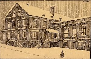
K�nstler Ansichtskarte / Postkarte Sohr, M., Gr�nhainichen in Sachsen, Hotel Deutsches Haus, Bes. Arthur L�tzsch
Manuscript / Paper Collectible
Condition: guter Zustand. ungelaufen, leicht beschnitten, sonst guter Zustand.
-
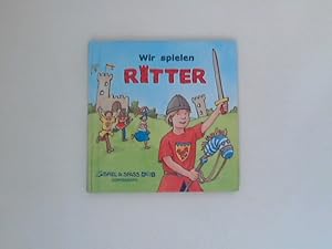
Wir spielen Ritter. Marianne Loibl ; ill. von Daniel Sohr / Spiel & Spass aktiv
Published by M�nster, Westf : Coppenrath, F, 2006
ISBN 10: 3815738946ISBN 13: 9783815738948
Book First Edition
Hardcover/Pappeinband. Condition: Gut. 1. Aufl. Einband leicht berieben, Sonst gut erhalten LIEFERZEITEN / DELIVERY TIMES: DEUTSCHLAND 6 - 10 Tage EUROPA/EUROPE: 7 - 30 Tage/Days USA/WELTWEIT/WORLDWIDE: 14 - 60 Tage/Days (!!!) +++ Sprache: Deutsch Gewicht in Gramm: 450.
-
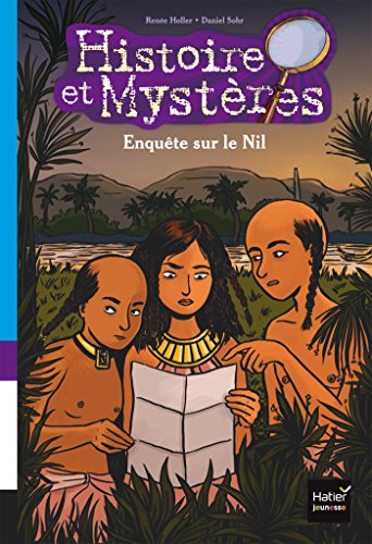
Enqu�te sur le Nil Holler, Ren�e; Sohr, Daniel et Boccador, Sabine
Published by HATIER JEUNESSE, 2017
ISBN 10: 240102784XISBN 13: 9782401027848
Book
Condition: like new. Sohr, Daniel (illustrator). EXPEDITION SOUS 48 H EN SUIVI LA POSTE / EMBALLAGE BULLEPACK.
-

Betrug beim Ritterturnier. Ein Krimi aus dem Mittelalter. Bilder von Daniel Sohr. (Leserabe)
Published by Ravensburger Buchverlag, Ravensburg, 2007
Sonderausgabe 58 S 21,5x15,2cm, illustr. Hardcover, Farbabbildungen, sehr guter Buchzustand.
-
Fairy Tales By Hans Christian Andersen Retold and Translated Dr. L. Sohr
Published by A. A. A. (Anton Appelmann), Urberach
Seller: Wonder Book, Frederick, MD, U.S.A.
Seller Rating:

Condition: Fair. Acceptable condition. Hardcover edition. Spine and front hinge cracked, splitting. Reading copy only. (Juvenile literature, Fairy Tales, Childrens stories).
-
Hardcover. Condition: Good. No Jacket. Gertraude Hecht Appelmann (illustrator). Slim volume in stiff gold boaeds with pasted on Appelmann illustration to front cover.Spine is partially stripped. No date but looks mid 20th century. Fine unmarked interior with colophon copyright Anton Appelmann Urberach, Printed in Germany Contains 10 tales each accompanied by stylish full page full color illustration.
-

Kein Einband. Condition: Gut. Original map from: Dr. K. Sohr: Volllst�ndiger Hand-Atlas des neueren Erdbeschreibung. Published: Flemming, Glogau Leipzig, 1844. Sheetsize: approx. 44 x 35 cm. Condition: please see photo for spotting or staining.
-
Kein Einband. Condition: Gut. Original map from: Dr. K. Sohr: Volllst�ndiger Hand-Atlas des neueren Erdbeschreibung. Published: Flemming, Glogau Leipzig, 1844. Sheetsize: approx. 44 x 35 cm. Condition: please see photo for spotting or staining - a small damage to image area.
-

Heute gehe ich auf den Bauernhof : kleine Geschichten zum Vorlesen. Henriette Wich ; Daniel Sohr
Published by Hamburg : Ellermann, 2004
ISBN 10: 3770759346ISBN 13: 9783770759347
Book First Edition
Pappeinband. [27] S. : zahlr. Ill. ; 25 cm Buch in guter Erhaltung, Einband sauber und vorwiegend unbesto�en, Seiten hell und sauber, ohne Eintr�ge, eine Seiten zum Kopf gering eingerissen Sprache: Deutsch Gewicht in Gramm: 323.
-
![Seller image for Das schwarze Drachenboot : ein Krimi aus der Wikingerzeit ; [mit Leser�tsel] / Fabian Lenk. Mit Bildern von Daniel Sohr for sale by Versandantiquariat Buchegger](https://pictures.abebooks.com/inventory/md/md31346990268.jpg)
Das schwarze Drachenboot : ein Krimi aus der Wikingerzeit ; [mit Leser�tsel] / Fabian Lenk. Mit Bildern von Daniel Sohr
Published by Ravensburger Buchverlag 2011 Ravensburg, 2011
kartoniert Schulausg. 21 cm Gut kein Schutzumschlag 58 S. / Sprache: deutsch / 220 g / Ges.-Titel: Leserabe : 3. Lesestufe / Weiter Info: zahlr. Ill. / Zustand: Einband an Ecken minimal gesto�en, Buchblock in Ordnung.
-
![Seller image for SOHR [pinback button] for sale by Bolerium Books Inc.](https://pictures.abebooks.com/inventory/md/md30591776732.jpg)
SOHR [pinback button]
Published by SOHR; mfg. by Lou Greene Printers [197-], [San Francisco]
Seller: Bolerium Books Inc., San Francisco, CA, U.S.A.
Seller Rating:
Manuscript / Paper Collectible
1.5 inch diameter pin, manufacturer's info over the curl. The San Francisco-based group helped organize opposition to the Briggs initiative.
-
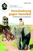
Verschw�rung gegen Hannibal - Ein Ratekrimi aus der R�merzeit Illustrationen von Daniel Sohr
Published by Loewe, 2003
ISBN 10: 3785548559ISBN 13: 9783785548554
Book First Edition
1., Aufl. 128 Seiten Gebraucht gut. Seite drei mit Namensstempel. Sprache: Deutsch Gewicht in Gramm: 221 19,4 x 13,2 x 1,8 cm, Gebundene Ausgabe.
More buying choices from other sellers on AbeBooks
Used offers from � 3.50
Also find Hardcover Softcover First Edition
-
Tarantas. Reiseeindr�cke. �bertragen von Helmut T. Heinrich, Nina Sohr, Elfiede Bergmann. Bearbeitet von Marga Erb. Mit 14 zeitgen�ssischen Illustrationen.
Published by Leipzig und Weimar. Gustav Kiepenheuer Verlag,, 1979
Book
Original-Leineneinband. 194 S. Eine Reise von Moskau nach Kasan - mitten im 19.Jahrhundert - kann leicht in einem Schlammloch enden. - Gut erhaltenes Exemplar. - Ohne Schutzumschlag. Sprache: Deutsch Gewicht in Gramm: 215.
-
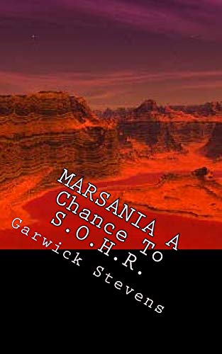
Marsania: A Chance to Sohr
Published by Createspace Independent Publishing Platform, 2014
ISBN 10: 1500311278ISBN 13: 9781500311278
Book Print on Demand
Paperback / softback. Condition: New. This item is printed on demand. New copy - Usually dispatched within 5-9 working days.
More buying choices from other sellers on AbeBooks
New offers from � 12.26
-

Koalas spurlos verschwunden!. Ein Ratekrimi aus Australien. Illustrationen von Daniel Sohr. Tatort Erde.
Published by Bindlach : Loewe,, 2005
ISBN 10: 3785553838ISBN 13: 9783785553831
Seller: Altstadt-Antiquariat Nowicki-Hecht UG, Leer, NDS, Germany
Association Member: GIAQ
Seller Rating:
Book First Edition
Condition: Gut. 1. Auflage;. 121 S. mit zahlreichen Abbildungen und Karten; 20 cm; Sehr guter Zustand. /lager 0258 ISBN: 9783785553831 Sprache: Deutsch Gewicht in Gramm: 600 gebunden, illustrierter Orig.-Pappband;
-
Tarantas. Reiseeindr�cke. �bertragen von Helmut T. Heinrich, Nina Sohr, Elfiede Bergmann. Bearbeitet v. Marga Erb. Mit 14 zeitgen�ssischen Illustrationen.
Published by Leipzig und Weimar. Gustav Kiepenheuer Verlag,, 1979
Book
194 S. Eine Reise von Moskau nach Kasan - mitten im 19.Jahrhundert - kann leicht in einem Schlammloch enden. - Gut erhaltenes Exemplar. - Umschlag mit kleinen Randl�suren. Sprache: Deutsch Gewicht in Gramm: 215 Original-Leineneinband mit Schutzumschlag.
-
Tarantas. Reiseeindr�cke. �bertragen von Helmut T. Heinrich, Nina Sohr, Elfiede Bergmann. Bearbeitet v. Marga Erb. Mit 14 zeitgen�ssischen Illustrationen.
Published by Leipzig und Weimar. Gustav Kiepenheuer Verlag,, 1979
Book
194 S. Eine Reise von Moskau nach Kasan - mitten im 19.Jahrhundert - kann leicht in einem Schlammloch enden. - Gut erhaltenes Exemplar. Sprache: Deutsch Gewicht in Gramm: 215 Original-Leineneinband mit Schutzumschlag.
-
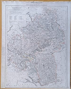
Kein Einband. Condition: Gut. Original map from: Dr. K. Sohr: Volllst�ndiger Hand-Atlas des neueren Erdbeschreibung. Published: Flemming, Glogau Leipzig, 1844. Sheetsize: approx. 44 x 35 cm. Condition: please see photo for spotting or staining.
-
Kein Einband. Condition: Gut. Original map from: Dr. K. Sohr: Volllst�ndiger Hand-Atlas des neueren Erdbeschreibung. Published: Flemming, Glogau Leipzig, 1844. Sheetsize: approx. 44 x 35 cm. Condition: please see photo for spotting or staining.
-
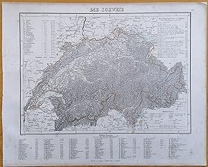
Kein Einband. Condition: Gut. Original map from: Dr. K. Sohr: Volllst�ndiger Hand-Atlas des neueren Erdbeschreibung. Published: Flemming, Glogau Leipzig, 1844. Sheetsize: approx. 44 x 35 cm. Condition: please see photo for spotting or staining.
-
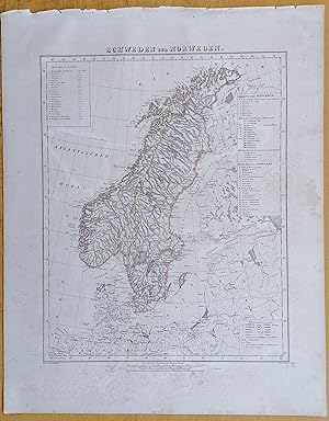
Kein Einband. Condition: Gut. Original map from: Dr. K. Sohr: Volllst�ndiger Hand-Atlas des neueren Erdbeschreibung. Published: Flemming, Glogau Leipzig, 1844. Sheetsize: approx. 44 x 35 cm. Condition: please see photo for spotting or staining.
-
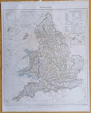
Kein Einband. Condition: Gut. Original map from: Dr. K. Sohr: Volllst�ndiger Hand-Atlas des neueren Erdbeschreibung. Published: Flemming, Glogau Leipzig, 1844. Sheetsize: approx. 44 x 35 cm. Condition: please see photo for spotting or staining - a small damage to image area.
-
Kein Einband. Condition: Gut. Original map from: Dr. K. Sohr: Volllst�ndiger Hand-Atlas des neueren Erdbeschreibung. Published: Flemming, Glogau Leipzig, 1844. Sheetsize: approx. 44 x 35 cm. Condition: please see photo for spotting or staining.
-
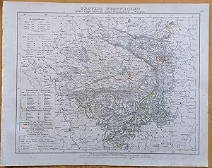
Kein Einband. Condition: Gut. Original map from: Dr. K. Sohr: Volllst�ndiger Hand-Atlas des neueren Erdbeschreibung. Published: Flemming, Glogau Leipzig, 1844. Sheetsize: approx. 44 x 35 cm. Condition: please see photo for spotting or staining.
-
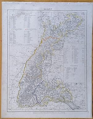
Kein Einband. Condition: Gut. Original map from: Dr. K. Sohr: Volllst�ndiger Hand-Atlas des neueren Erdbeschreibung. Published: Flemming, Glogau Leipzig, 1844. Sheetsize: approx. 44 x 35 cm. Condition: please see photo for spotting or staining.
-
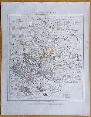
Kein Einband. Condition: Gut. Original map from: Dr. K. Sohr: Volllst�ndiger Hand-Atlas des neueren Erdbeschreibung. Published: Flemming, Glogau Leipzig, 1844. Sheetsize: approx. 44 x 35 cm. Condition: please see photo for spotting or staining.
-
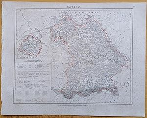
Kein Einband. Condition: Gut. Original map from: Dr. K. Sohr: Volllst�ndiger Hand-Atlas des neueren Erdbeschreibung. Published: Flemming, Glogau Leipzig, 1844. Sheetsize: approx. 44 x 35 cm. Condition: please see photo for spotting or staining.
-
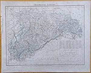
Kein Einband. Condition: Gut. Original map from: Dr. K. Sohr: Volllst�ndiger Hand-Atlas des neueren Erdbeschreibung. Published: Flemming, Glogau Leipzig, 1844. Sheetsize: approx. 44 x 35 cm. Condition: please see photo for spotting or staining.
-
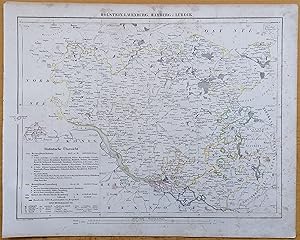
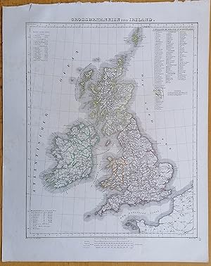
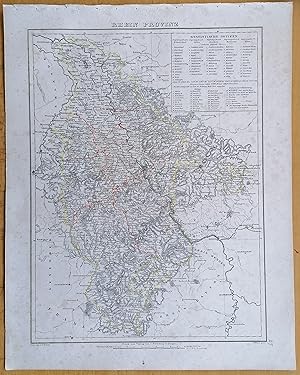
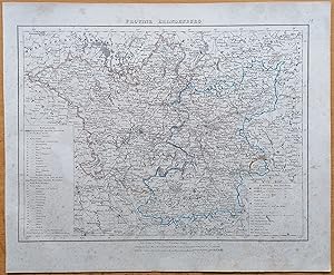
Sohr Original Map Germany Hostein Lauenburg Hamburg L�beck - 1844
Published by Flemming, Glogau, 1844
Map
Kein Einband. Condition: Gut. Original map from: Dr. K. Sohr: Volllst�ndiger Hand-Atlas des neueren Erdbeschreibung. Published: Flemming, Glogau Leipzig, 1844. Sheetsize: approx. 44 x 35 cm. Condition: please see photo for spotting or staining.
-
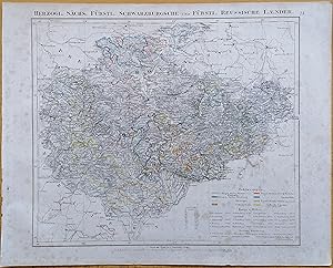
Sohr Original Map Germany Schwarzburgsche und Reussische L�nder - 1844
Published by Flemming, Glogau, 1844
Map
Kein Einband. Condition: Gut. Original map from: Dr. K. Sohr: Volllst�ndiger Hand-Atlas des neueren Erdbeschreibung. Published: Flemming, Glogau Leipzig, 1844. Sheetsize: approx. 44 x 35 cm. Condition: please see photo for spotting or staining.