Order Total (1 Item Items):
Shipping Destination:

Descriptive List Printed Maps Yorkshire by Whitaker Harold (17 results)
Skip to main search results
Search filters
Product Type
- All Product Types
- Books (17)
- Magazines & Periodicals (No further results match this refinement)
- Comics (No further results match this refinement)
- Sheet Music (No further results match this refinement)
- Art, Prints & Posters (No further results match this refinement)
- Photographs (No further results match this refinement)
- Maps (No further results match this refinement)
- Manuscripts & Paper Collectibles (No further results match this refinement)
Condition Learn more
- New (13)
- As New, Fine or Near Fine (No further results match this refinement)
- Very Good or Good (3)
- Fair or Poor (No further results match this refinement)
- As Described (1)
Binding
Collectible Attributes
- First Edition (No further results match this refinement)
- Signed (No further results match this refinement)
- Dust Jacket (No further results match this refinement)
- Seller-Supplied Images (5)
- Not Print on Demand (11)
Language (2)
Free Shipping
Seller Location
Seller Rating
-

A Descriptive List of the Printed Maps of Yorkshire and Its Ridings, 1577-1900
Published by Yorkshire Archaeological Society, 1971
Language: English
Hardcover. Condition: Very Good. No Jacket. Reprint. Brown cloth, 261 pages, 9-in tall, many maps. Reprint of a title published in 1933. Published as Record Series Vol. LXXXVI For the Year 1933. A clean copy with minor edge wear.
-

A Descriptive List of the Printed Maps of Yorkshire and its Ridings, 1577-1900 (Cambridge Library Collection - British and Irish History, General)
Published by Cambridge University Press, 2013
ISBN 10: 1108058825 ISBN 13: 9781108058827
Language: English
Condition: New.
-
A Descriptive List of the Printed Maps of Yorkshire and its Ridings, 1577-1900 (Cambridge Library Collection - British and Irish History, General)
Published by Cambridge University Press, 2013
ISBN 10: 1108058825 ISBN 13: 9781108058827
Language: English
Seller: Ria Christie Collections, Uxbridge, United Kingdom
Seller rating 5 out of 5 stars

Condition: New. In.
-
A Descriptive List of the Printed Maps of Yorkshire and its Ridings, 15771900 (Paperback)
Published by Cambridge University Press, Cambridge, 2013
ISBN 10: 1108058825 ISBN 13: 9781108058827
Language: English
Paperback. Condition: new. Paperback. Originally founded in 1863 to promote interest in the history and archaeology of the Huddersfield area, the Yorkshire Archaeological Society expanded its purview in 1870 to cover the whole of Yorkshire. In 1884 it began publishing its Record Series, which aimed to make historical information available through the reprinting of original documents, diaries, letters, and charters. First published in 1933 and reprinted for the society in 1971, this well-illustrated work is an extensive catalogue of maps of the Yorkshire area, drawn between 1577 and 1900. The editor's introduction sets the maps within the history of cartography in Britain, and in the context of pioneering work by previous cartographers. The entries give a description of what each map depicts, along with information on dates and dimensions. This work remains a valuable resource for local historians and geographers. First published for the Yorkshire Archaeological Society in 1933 and reprinted in 1971, this is an extensive and well-illustrated catalogue of maps of the Yorkshire region, drawn between 1577 and 1900, with informative descriptions. It remains of value to local historians and geographers. Shipping may be from multiple locations in the US or from the UK, depending on stock availability.
-
A Descriptive List of the Printed Maps of Yorkshire and Its Ridings, 1577 1900
Published by Cambridge University Press CUP, 2013
ISBN 10: 1108058825 ISBN 13: 9781108058827
Language: English
Condition: New. pp. 318.
-

Descriptive List of the Printed Maps of Yorkshire and Its Ridings, 1577-1900 (Yorkshire Archaeological Society. Record series)
Published by Yorkshire Archaeological Society, 1971
ISBN 10: 0902122088 ISBN 13: 9780902122086
Language: English
Seller: Books for Libraries, Inc., Santa Clarita, CA, U.S.A.
Seller rating 4 out of 5 stars

Hardcover. Condition: Very Good. 1971 Hardcover. Many fold-out maps intact. No former owner's name or marks. Text is clean, Binding is strong. Nice tan cloth cover with gold lettering & stamped borders, a few light scratches in cloth.
-
A Descriptive List of the Printed Maps of Yorkshire and its Ridings, 15771900 (Paperback)
Published by Cambridge University Press, Cambridge, 2013
ISBN 10: 1108058825 ISBN 13: 9781108058827
Language: English
Paperback. Condition: new. Paperback. Originally founded in 1863 to promote interest in the history and archaeology of the Huddersfield area, the Yorkshire Archaeological Society expanded its purview in 1870 to cover the whole of Yorkshire. In 1884 it began publishing its Record Series, which aimed to make historical information available through the reprinting of original documents, diaries, letters, and charters. First published in 1933 and reprinted for the society in 1971, this well-illustrated work is an extensive catalogue of maps of the Yorkshire area, drawn between 1577 and 1900. The editor's introduction sets the maps within the history of cartography in Britain, and in the context of pioneering work by previous cartographers. The entries give a description of what each map depicts, along with information on dates and dimensions. This work remains a valuable resource for local historians and geographers. First published for the Yorkshire Archaeological Society in 1933 and reprinted in 1971, this is an extensive and well-illustrated catalogue of maps of the Yorkshire region, drawn between 1577 and 1900, with informative descriptions. It remains of value to local historians and geographers. Shipping may be from our UK warehouse or from our Australian or US warehouses, depending on stock availability.
-
A Descriptive List of the Printed Maps of Yorkshire and its Ridings, 15771900 (Paperback)
Published by Cambridge University Press, Cambridge, 2013
ISBN 10: 1108058825 ISBN 13: 9781108058827
Language: English
Paperback. Condition: new. Paperback. Originally founded in 1863 to promote interest in the history and archaeology of the Huddersfield area, the Yorkshire Archaeological Society expanded its purview in 1870 to cover the whole of Yorkshire. In 1884 it began publishing its Record Series, which aimed to make historical information available through the reprinting of original documents, diaries, letters, and charters. First published in 1933 and reprinted for the society in 1971, this well-illustrated work is an extensive catalogue of maps of the Yorkshire area, drawn between 1577 and 1900. The editor's introduction sets the maps within the history of cartography in Britain, and in the context of pioneering work by previous cartographers. The entries give a description of what each map depicts, along with information on dates and dimensions. This work remains a valuable resource for local historians and geographers. First published for the Yorkshire Archaeological Society in 1933 and reprinted in 1971, this is an extensive and well-illustrated catalogue of maps of the Yorkshire region, drawn between 1577 and 1900, with informative descriptions. It remains of value to local historians and geographers. Shipping may be from our Sydney, NSW warehouse or from our UK or US warehouse, depending on stock availability.
-
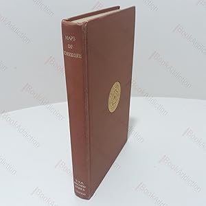
A Descriptive List of the Printed Maps of Yorkshire and its Ridings, 1577-1900 (The Yorkshire Archaelogical Society : The Record Series Vol. LXXXVI for the Year 1933)
Published by The Yorkshire Archaeological Society, Leeds, UK, 1971
Seller: BookAddiction (IOBA, IBooknet), Canterbury, United Kingdom
Association Member: IOBA
Seller rating 5 out of 5 stars
Hardcover. Condition: Very Good. 1971 Reprint. xiv, 262pp, 23 illustrations and fold out maps (including frontispiece) in black and white. Umber cloth-covered boards with gilt titles on spine and gilt design on front. Rubbed spine ends. Some bumping along bottom edge and shelf wear. Evidence of previous labels on front end papers. Slightly loose binding. Otherwise, internally neat, clean and bright. 8vo. A bibliographic examination of printed maps of Yorkshire from around the beginning of the 16th century, with reproductions of some beautifully engraved maps and some curious and rarer ones.
-

A Descriptive List of the Printed Maps of Yorkshire and Its Ridings, 1577 1900
Published by Cambridge University Press, 2013
ISBN 10: 1108058825 ISBN 13: 9781108058827
Language: English
Taschenbuch. Condition: Neu. Druck auf Anfrage Neuware - Printed after ordering - Originally founded in 1863 to promote interest in the history and archaeology of the Huddersfield area, the Yorkshire Archaeological Society expanded its purview in 1870 to cover the whole of Yorkshire. In 1884 it began publishing its Record Series, which aimed to make historical information available through the reprinting of original documents, diaries, letters, and charters. First published in 1933 and reprinted for the society in 1971, this well-illustrated work is an extensive catalogue of maps of the Yorkshire area, drawn between 1577 and 1900. The editor's introduction sets the maps within the history of cartography in Britain, and in the context of pioneering work by previous cartographers. The entries give a description of what each map depicts, along with information on dates and dimensions. This work remains a valuable resource for local historians and geographers.
-
A Descriptive List of the Printed Maps of Yorkshire and its Ridings, 1577-1900
Published by The Yorkshire Archaelogical Society, Yorkshire, 1971
Seller: Muir Books [Robert Muir Old & Rare Books], PERTH, WA, Australia
Association Member: ANZAAB ILAB
Seller rating 5 out of 5 stars
Cloth Boards. Reprint. Reprint, 8vo, pp. xiv, 261, Index, b/w frontis, b/w folded plates, original cloth boards, very good. Reprint of The Yorkshire Archaelogical Society Record Series, Volume LXXXVI for the Year 1933.
-
A Descriptive List of the Printed Maps of Yorkshire and its Ridings, 1577-1900
Published by Cambridge University Press, 2013
ISBN 10: 1108058825 ISBN 13: 9781108058827
Language: English
Paperback. Condition: Brand New. 318 pages. 8.98x5.98x0.94 inches. In Stock. This item is printed on demand.
-
![Seller image for YAS Record Series Vol. 86: A descriptive list of the printed maps of Yorkshire and its Ridings 1577 - 1900 1933 [LeatherBound] for sale by True World of Books](https://pictures.abebooks.com/inventory/md/md31618584699.jpg)
LeatherBound. Condition: New. BOOKS ARE EXEMPT FROM IMPORT DUTIES AND TARIFFS; NO EXTRA CHARGES APPLY. LeatherBound edition. Condition: New. Reprinted from 1933 edition. Leather Binding on Spine and Corners with Golden leaf printing on spine. Bound in genuine leather with Satin ribbon page markers and Spine with raised gilt bands. A perfect gift for your loved ones. Pages: 336 NO changes have been made to the original text. This is NOT a retyped or an ocr'd reprint. Illustrations, Index, if any, are included in black and white. Each page is checked manually before printing. As this print on demand book is reprinted from a very old book, there could be some missing or flawed pages, but we always try to make the book as complete as possible. Fold-outs, if any, are not part of the book. If the original book was published in multiple volumes then this reprint is of only one volume, not the whole set. Sewing binding for longer life, where the book block is actually sewn (smythe sewn/section sewn) with thread before binding which results in a more durable type of binding. Pages: 336.
-
A Descriptive List of the Printed Maps of Yorkshire and Its Ridings, 1577 1900
Published by Cambridge University Press, 2013
ISBN 10: 1108058825 ISBN 13: 9781108058827
Language: English
Condition: New. Print on Demand pp. 318 23 Illus.
-
A Descriptive List of the Printed Maps of Yorkshire and Its Ridings, 1577 1900
Published by Cambridge University Press, 2013
ISBN 10: 1108058825 ISBN 13: 9781108058827
Language: English
Condition: New. PRINT ON DEMAND pp. 318.
-

A Descriptive List of the Printed Maps of Yorkshire and Its Ridings, 1577 1900
Published by Cambridge University Press, 2013
ISBN 10: 1108058825 ISBN 13: 9781108058827
Language: English
Condition: New. Dieser Artikel ist ein Print on Demand Artikel und wird nach Ihrer Bestellung fuer Sie gedruckt. First published for the Yorkshire Archaeological Society in 1933 and reprinted in 1971, this is an extensive and well-illustrated catalogue of maps of the Yorkshire region, drawn between 1577 and 1900, with informative descriptions. It remains of value to l.
-
A Descriptive List of the Printed Maps of Yorkshire and Its Ridings, 1577 1900
Published by Cambridge University Press, 2013
ISBN 10: 1108058825 ISBN 13: 9781108058827
Language: English
Taschenbuch. Condition: Neu. A Descriptive List of the Printed Maps of Yorkshire and Its Ridings, 1577 1900 | Harold Whitaker | Taschenbuch | Kartoniert / Broschiert | Englisch | 2013 | Cambridge University Press | EAN 9781108058827 | Verantwortliche Person f�r die EU: Libri GmbH, Europaallee 1, 36244 Bad Hersfeld, gpsr[at]libri[dot]de | Anbieter: preigu Print on Demand.