Items related to Philip's Street Atlas North Yorkshire: Spiral Edition

THE ONLY COUNTY STREET ATLAS WITH ALL THE NAMED STREETS OF NORTH YORKSHIRE,
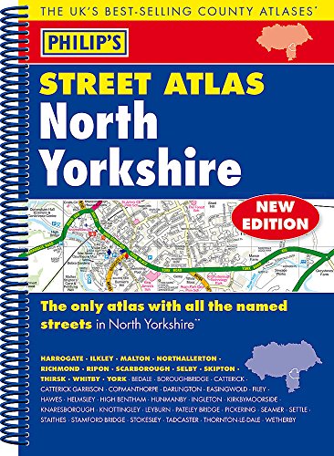
The UK's best-selling county street atlases
More than 24,000 named streets, roads, lanes and alleys
The essential map books for residents and visitors - and if you're moving to North Yorkshire
Includes all the streets in HARROGATE, ILKLEY, MALTON, NORTHALLERTON, RICHMOND, RIPON, SCARBOROUGH, SELBY, SKIPTON, THIRSK, WHITBY, YORK, BEDALE, BOROUGHBRIDGE, CATTERICK, Catterick Garrison, Copmanthorpe, Darlington, Easingwold, Filey, Hawes, Helmsley, High Bentham, Hunmanby, Ingleton, Kirkbymoorside, Knaresborough, Knottingley, Leyburn, Pateley Bridge, Pickering, Seamer, Settle, Staithes, Stamford Bridge, Stokesley, Tadcaster, Thornton-le-Dale, Wetherby.
- New edition in practical spiral-bound format
- Street maps show car parks, schools, hospitals and many other places of interest, even ones off the beaten path
- 4-page practical route-planning section showing all A and B roads
- Super-clear mapping
- Easy-to-use index
- Scales: 1� inches to 1 mile (1:36,000) and 3� inches to 1 mile (1:18,000). Major towns: 7 inches to 1 mile (1:9,000).
Other information on the maps includes postcode boundaries, car parks, railway and bus stations, post offices, schools, colleges, hospitals, police and fire stations, places of worship, leisure centres, footpaths and bridleways, camping and caravan sites, golf courses, and many other places of interest.
"synopsis" may belong to another edition of this title.
Book Description:
A fully updated edition of this spiral-bound Philip's street atlas of North Yorkshire, giving comprehensive coverage of the county. The atlas is suitable for both business and leisure use.
"About this title" may belong to another edition of this title.
- PublisherPhilip's
- Publication date2015
- ISBN 10 1849073686
- ISBN 13 9781849073684
- BindingPaperback
- Number of pages288
Other Popular Editions of the Same Title
Top Search Results from the AbeBooks Marketplace

Stock Image
Philip's Street Atlas North Yorkshire
Seller:
Rating
Book Description Condition: Very Good. 1708589852. 2/22/2024 8:17:32 AM. Seller Inventory # U9781849073684
Buy Used
� 14.53
Convert currency
Seller Image
Philip's Street Atlas North Yorkshire: Spiral Edition
Seller:
Rating
Book Description Condition: VeryGood. Most items will be dispatched the same or the next working day. Seller Inventory # wbs1635551202
Buy Used
� 27.26
Convert currency
Stock Image
Philip's Street Atlas North Yorkshire: Spiral Edition
Published by
Octopus Publishing Group, United Kingdom, London
(2015)
ISBN 10: 1849073686
ISBN 13: 9781849073684
Used
Paperback
Quantity: 1
Seller:
Rating
Book Description Paperback. Condition: Good. THE ONLY COUNTY STREET ATLAS WITH ALL THE NAMED STREETS OF NORTH YORKSHIRE, The UK's best-selling county street atlases More than 24,000 named streets, roads, lanes and alleys The essential map books for residents and visitors - and if you're moving to North Yorkshire Includes all the streets in HARROGATE, ILKLEY, MALTON, NORTHALLERTON, RICHMOND, RIPON, SCARBOROUGH, SELBY, SKIPTON, THIRSK, WHITBY, YORK, BEDALE, BOROUGHBRIDGE, CATTERICK, Catterick Garrison, Copmanthorpe, Darlington, Easingwold, Filey, Hawes, Helmsley, High Bentham, Hunmanby, Ingleton, Kirkbymoorside, Knaresborough, Knottingley, Leyburn, Pateley Bridge, Pickering, Seamer, Settle, Staithes, Stamford Bridge, Stokesley, Tadcaster, Thornton-le-Dale, Wetherby. - New edition in practical spiral-bound format - Street maps show car parks, schools, hospitals and many other places of interest, even ones off the beaten path - 4-page practical route-planning section showing all A and B roads - Super-clear mapping - Easy-to-use index - Scales: 1 inches to 1 mile (1:36,000) and 3 inches to 1 mile (1:18,000). Major towns: 7 inches to 1 mile (1:9,000). Other information on the maps includes postcode boundaries, car parks, railway and bus stations, post offices, schools, colleges, hospitals, police and fire stations, places of worship, leisure centres, footpaths and bridleways, camping and caravan sites, golf courses, and many other places of interest. The book has been read but remains in clean condition. All pages are intact and the cover is intact. Some minor wear to the spine. Seller Inventory # GOR008481448
Buy Used
� 50.08
Convert currency
Stock Image
Philip's Street Atlas North Yorkshire
Seller:
Rating
Book Description Condition: Very Good. Book is in Used-VeryGood condition. Pages and cover are clean and intact. Used items may not include supplementary materials such as CDs or access codes. May show signs of minor shelf wear and contain very limited notes and highlighting. Seller Inventory # 1849073686-2-3
Buy Used
� 74.84
Convert currency
Stock Image
Philip's Street Atlas North Yorkshire
Seller:
Rating
Book Description Condition: Very Good. Very Good condition. Shows only minor signs of wear, and very minimal markings inside (if any). Seller Inventory # 353-1849073686-vrg
Buy Used
� 115.01
Convert currency