Items related to John Speed Map of Buckinghamshire 1611: 30" x 25"...
John Speed Map of Buckinghamshire 1611: 30" x 25" Large Photographic Poster Print of the County of Buckinghamshire - England
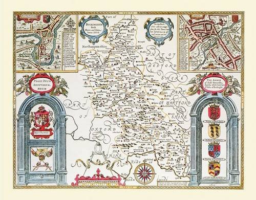

There are plans of Old Buckingham and Reading on the top corners of this map,Reading unusually being shown as it is actually located in Berkshire. Depicted on the bottom left are the coats of arms of the Earls of Buckingham,complemented by two armorial devices on the opposite side. Shown on the map is the River Thames, which provides the county with its southern border,and nearby Eton, home of the famous Public School.
"synopsis" may belong to another edition of this title.
- PublisherHistorical Images Ltd
- Publication date2010
- ISBN 10 1844914291
- ISBN 13 9781844914296
- BindingMap
(No Available Copies)
Search Books: Create a WantIf you know the book but cannot find it on AbeBooks, we can automatically search for it on your behalf as new inventory is added. If it is added to AbeBooks by one of our member booksellers, we will notify you!
Create a Want