Items related to Philip's Street Atlas Fife and Tayside
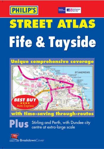

New, and the only detailed colour atlas of Fife & Tayside that gives comprehensive coverage of the region from Brechin and Montrose in the north-east to Stirling in the south-west and including Kincardine and Queensferry.The mapping is based on Ordnance Survey data and gives the user complete coverage of all urban and rural areas. The mapping is at a scale of 1 3/4 inches to 1 mile (1 1/4 inches to 1 mile in the pocket edition) with larger scale mapping of 3 1/2 inches to 1 mile (2 1/2 inches to 1 mile in the pocket edition) in the south and for the following towns Arbroath, Auchterarder, Brechin, Carnoustie, Crieff, Cupar, Dunblane, Dundee, Forfar, Glenrothes, Kinross, Kirriemuir, Leven, Montrose, Perth, Rattray, St Andrews, The mapping is also complete with postcode boundaries.The atlas is ideally suited for both business and leisure use. There is a route-planning map at the front of the atlas. The main maps show every named road, street and lane clearly with through-routes highlighted. School locations are marked and emergency services, hospitals, police stations, car parks and rail and bus station locations are all featured. There is a comprehensive index of street names and postcodes including schools, industrial estates, hospitals, sports centres, etc. These are highlighted in red.Main map scale: 1.75 inches to 1 mile and 3.5 inches to 1 mile
"synopsis" may belong to another edition of this title.
Review:
'Best Buy' *****AUTO EXPRESS
Book Description:
The only detailed colour atlas of Fife & Tayside that gives comprehensive coverage of the region from Brechin and Montrose in the north-east to Stirling in the south-west and including Kincardine and Queensferry.
"About this title" may belong to another edition of this title.
- PublisherPhilip's
- Publication date2004
- ISBN 10 054008526X
- ISBN 13 9780540085262
- BindingPaperback
- Number of pages216
Top Search Results from the AbeBooks Marketplace

Stock Image
Philip's Street Atlas Fife and Tayside
Published by
Philip's OS Publications
(2004)
ISBN 10: 054008526X
ISBN 13: 9780540085262
Used
Paperback
Quantity: 5
Seller:
Rating
Book Description Paperback. Condition: Very Good. The book has been read, but is in excellent condition. Pages are intact and not marred by notes or highlighting. The spine remains undamaged. Seller Inventory # GOR003900009
Buy Used
� 1.46
Convert currency
Stock Image
Philip's Street Atlas Fife and Tayside
Published by
Philip's OS Publications
(2004)
ISBN 10: 054008526X
ISBN 13: 9780540085262
Used
Paperback
Quantity: 1
Seller:
Rating
Book Description Paperback. Condition: Good. The book has been read but remains in clean condition. All pages are intact and the cover is intact. Some minor wear to the spine. Seller Inventory # GOR001832673
Buy Used
� 1.46
Convert currency
Stock Image
Fife and Tayside
Published by
Octopus Publishing Group
(2004)
ISBN 10: 054008526X
ISBN 13: 9780540085262
Used
Softcover
Quantity: 1
Seller:
Rating
Book Description Condition: Good. Ships from the UK. Used book that is in clean, average condition without any missing pages. Seller Inventory # 39327275-20
Buy Used
� 4.41
Convert currency
Stock Image
Street Atlas Fife and Tayside
Published by
Philip's OS Publications
(2004)
ISBN 10: 054008526X
ISBN 13: 9780540085262
Used
Paperback
Quantity: 1
Seller:
Rating
Book Description Paperback. Condition: Used; Good. ***Simply Brit*** Welcome to our online used book store, where affordability meets great quality. Dive into a world of captivating reads without breaking the bank. We take pride in offering a wide selection of used books, from classics to hidden gems, ensuring there is something for every literary palate. All orders are shipped within 24 hours and our lightning fast-delivery within 48 hours coupled with our prompt customer service ensures a smooth journey from ordering to delivery. Discover the joy of reading with us, your trusted source for affordable books that do not compromise on quality. Seller Inventory # mon0001595567
Buy Used
� 4.11
Convert currency