Items related to Postcode Atlas of Britain and Northern Ireland

Main Maps 1:263,000 (4.15 miles to 1 inch).
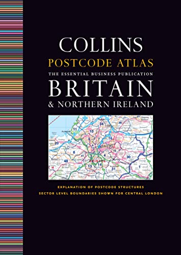
An essential business tool, this atlas, clearly shows the postcode boundaries (down to district level) for the whole country on detailed colour mapping. In central London postcodes are shown to sector level.
MAIN FEATURES
This invaluable atlas shows postcode areas and districts for the whole of the UK and has been updated with all the latest boundary changes.
INCLUDES
� Shows postcode areas (e.g. SW) and postcode districts (e.g. SW8) for the whole of the UK .
� Central London is shown down to sector level (e.g. SW8 4).
� Busy conurbation areas are shown at an enlarged scale of 1.6 miles to 1 inch.
� Information on the structure and uses of postcodes.
� Gazetteer listing and a full colour map of the administrative areas incorporating administrative changes happening in April 2009.
� Full index to place names.
� Index to postcode abbreviations.
� Comprehensive background map detail which means the atlas can also be used for route planning and navigation.
AREA OF COVERAGE
Covers the whole of Britain and Northern Ireland.
WHO THE PRODUCT IS OF INTEREST TO
This atlas is aimed at the business user who will find it an invaluable tool for many applications including market analysis, distribution planning and sales territory organisation.
"synopsis" may belong to another edition of this title.
Product Description:
Britain & Northern IrelandThis invaluable atlas shows postcode areas and districts for the whole of the UK and has been fully updated with all the latest boundary changesCentral London is shown down to sector levelMain maps at 4.15 miles to 1 inchBusy conurbation areas are shown at an enlarged scale of 1.6 miles to 1 inchGazetteer listing of administrative areasFull index to place namesSize: A4
"About this title" may belong to another edition of this title.
- PublisherCollins
- Publication date2009
- ISBN 10 0007312008
- ISBN 13 9780007312009
- BindingHardcover
- Edition number6
- Number of pages224
Top Search Results from the AbeBooks Marketplace

Stock Image
Postcode Atlas of Britain and Northern Ireland
Published by
HarperCollins UK
(2009)
ISBN 10: 0007312008
ISBN 13: 9780007312009
Used
Hardcover
Quantity: 1
Seller:
Rating
Book Description Hardback. Condition: Very Good. The book has been read, but is in excellent condition. Pages are intact and not marred by notes or highlighting. The spine remains undamaged. Seller Inventory # GOR005383669
Buy Used
� 7.88
Convert currency