Items related to Handy Map Ireland
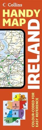

Scale: 10 miles to 1 inch 1:633,600. This route planning map is extremely easy to use, and has lamination on both sides making it very hard wearing. New mapping has been created for 2006.
MAIN FEATURES
This durable laminated map opens almost like a book, giving it the convenience of an atlas with all the benefits of a fold out map. It features clear full colour mapping at 10 miles to 1 inch and city centre plans of Belfast & Dublin.
INCLUDES
� Distance chart on back of map
� Roads colour classified
� Areas of tourist interest, plus Tourist Information Centres and offices shown
AREA OF COVERAGE
Covers the whole of the Republic of Ireland plus Northern Ireland.
WHO THE PRODUCT IS OF INTEREST TO
Anyone who would like a durable, handy format, route planning map of the whole of Ireland, from tourist to business user.
"synopsis" may belong to another edition of this title.
- PublisherCollins
- Publication date2006
- ISBN 10 000720423X
- ISBN 13 9780007204236
- BindingMap
Top Search Results from the AbeBooks Marketplace

Stock Image
IRELAND HANDY MAP*
Seller:
Rating
Book Description Map. Condition: As New. Seller Inventory # 210828154
Buy Used
� 24.20
Convert currency
Stock Image
IRELAND HANDY MAP*
Seller:
Rating
Book Description Condition: Good. SHIPS FROM USA. Used books have different signs of use and do not include supplemental materials such as CDs, Dvds, Access Codes, charts or any other extra material. All used books might have various degrees of writing, highliting and wear and tear and possibly be an ex-library with the usual stickers and stamps. Dust Jackets are not guaranteed and when still present, they will have various degrees of tear and damage. All images are Stock Photos, not of the actual item. book. Seller Inventory # 20-000720423X-G
Buy Used
� 31.68
Convert currency