Items related to Newcastle, Sunderland and the North East (Regional...
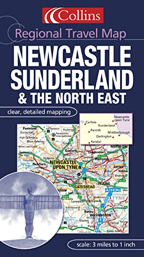

Scale: Road mapping 1:190000 3 miles to 1 inch, Urban mapping at 1:63360 1 mile to 1 inch.
One of a series of sheet maps with a combination of road mapping and detailed urban mapping plus street level town and city centre plans.
MAIN FEATURES
Brand new card covered sheet map of the north east of England with mapping at various scales to aid navigation. The road mapping is at 3 miles to 1 inch and is in the popular easy to use Collins style. This road mapping covers the whole of north east England extending down to Kendal in the south. The detailed urban mapping has roads numbered and named and covers the Newcastle area. There are also city centre plans showing street level detail.
INCLUDES
� 3 miles to 1 inch road mapping
� 1 mile to 1 inch urban mapping with roads classified and named
� City centre plans of Newcastle, Sunderland, Middlesbrough and Carlisle
� Full index to place names
AREA OF COVERAGE
The road mapping extends from Newcastle in the north to Kendal in the south and from Carlisle in the west to the coast in the east.
WHO THIS PRODUCT IS OF INTEREST TO
This is an ideal product for those who live, work or want to tour around this area.
"synopsis" may belong to another edition of this title.
- PublisherCollins
- Publication date2003
- ISBN 10 0007160941
- ISBN 13 9780007160945
- BindingMap
(No Available Copies)
Search Books: Create a WantIf you know the book but cannot find it on AbeBooks, we can automatically search for it on your behalf as new inventory is added. If it is added to AbeBooks by one of our member booksellers, we will notify you!
Create a Want