Items related to London Photographic Atlas
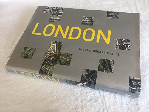

This is the most revealing London atlas ever published. ‘LONDON: The Photographic Atlas’ combines the vertical aerial photography of Getmapping.com, creators of the Millennium Map, with Collins' acclaimed street mapping – an unbeatable combination of photography and cartography.
If you live in Greater London, you will already possess a personal stake in this book – within its pages you will be able to find your house, perhaps locate your car parked in the street, trace your route to work, and visit some of your favourite places. On closer inspection you will spot patterns that are invisible from the ground, discover surprising links between unconnected areas, find large areas of greenery that you never knew existed, and explore new neighbourhoods for the first time. Even if you don't know London well, you will find this book fascinating.
The photographic atlas is easy to use. The photography and the cartography share the same standard grid system, meaning you can cross-reference quickly between the two elements; both photography and cartography are 'map accurate', as the photography has been geo-corrected, a process that removes the distortions in the original aerial photography; and throughout the whole book the grid interval is 500 metres, so that distances can be accurately assessed. Finally, every street in Greater London – more than 50,000 in total – has been indexed with two page numbers – one relating to the photography and the other relating to the cartography.
LONDON: THE PHOTOGRAPHIC ATLAS is the first title in an exciting new series of books from HarperCollins Illustrated that tie in the Millennium Map, a contemporary Domesday Book destined to be a social record of the utmost historical importance.
"synopsis" may belong to another edition of this title.
Review:
Getmapping.com came up with a beautifully simple idea in 1998: photograph the whole of the UK from the air to create a kind of modern Doomsday Book. Then they and HarperCollins realised that the London part of the survey would give a unique view of one of the world's most famous cities, and so this book was born. It really is unbelievably simple, and of interest to any lover of London who also enjoys maps and photographs. Getmapping.com flew a plane at 5,500 feet taking photos automatically, then digitised the photos so they could be colour-corrected and adjusted to allow for variations in light, weather, contours and the plane's flight. The result is a homogenous set of photographs of the whole city, with a conventional street atlas stuck on the back. Every street in London is indexed to both the photographic and the cartographic atlas, so you should be able to find any place you want quickly and easily.
Review:
A word about the scale of the photos, particularly about what the potential reader can expect to see clearly: in order to make the size of the book manageable, the scale increases as you move out from the centre. There are 74 pages of central London (Regent's Park to the South Bank, and Earls Court to Whitechapel) at 1:3000, 112 of inner London (Richmond to the Isle of Dogs, Highgate to Dulwich) at 1:6000, 96 of outer London at 1:12000, and 40 pages of cartography covering the whole of London at 1: 24000. In central London the roofs of individual houses can be picked out easily; in inner London they are still discernible, though not so clearly; by the time you get to outer London it's more a question of finding a street. --David Pickering
'Drop heavy hints to Santa about London: The Photographic Atlas ... a sublime book ... an amazing labour of love' The Guardian
'Warning – don't buy this book! You will spend hours and hours, if not days and weeks, poring over its amazing detail. For lovers of London it is a must' Ken Livingstone, Mayor of London
'A fascinating book ... it contains all the passion of a great city ... fun for all the family' Rowan Moore, Evening Standard
'Absolutely brilliant' Chris Tarrant, Capital Radio
"About this title" may belong to another edition of this title.
- PublisherHarperCollins Illustrated
- Publication date2000
- ISBN 10 0007108419
- ISBN 13 9780007108411
- BindingHardcover
- Number of pages400
Buy New
Learn more about this copy
� 41.90
Shipping:
� 3.24
Within U.S.A.
Top Search Results from the AbeBooks Marketplace
Stock Image
London : The Photographic Atlas
Published by
Harpercollins Pub Ltd
ISBN 10: 0007108419
ISBN 13: 9780007108411
New
Hardcover
Quantity: 1
Seller:
Rating
Book Description Hardcover. Condition: new. New. Fast Shipping and good customer service. Seller Inventory # Holz_New_0007108419
Buy New
� 41.90
Convert currency
Stock Image
London : The Photographic Atlas
Published by
Harpercollins Pub Ltd
ISBN 10: 0007108419
ISBN 13: 9780007108411
New
Hardcover
Quantity: 1
Seller:
Rating
Book Description Hardcover. Condition: new. New. Seller Inventory # Wizard0007108419
Buy New
� 128.42
Convert currency
Stock Image
London: The Photographic Atlas
Published by
Harpercollins Pub Ltd
(2001)
ISBN 10: 0007108419
ISBN 13: 9780007108411
New
Hardcover
Quantity: 1
Seller:
Rating
Book Description Hardcover. Condition: New. Brand New!. Seller Inventory # VIB0007108419
Buy New
� 131.90
Convert currency