Items related to Britain Atlas and Gazetteer

1:263,000 4.15 miles to 1 inch This Gazetteer aims to be the most comprehensive available for Great Britain and will include over 55,000 entries complete with brief description, feature type and National Grid Reference.
MAIN FEATURES
� Gazetteer section covering over 55,000 places complete with a brief description
� 108 pages of full colour mapping at 4.15 miles to 1 inch
� Full colour mapping showing administrative areas
INCLUDES
� London urban area mapping
� Population statistics from the latest census
� Administrative area listing including descriptions plus population statistics
AREA OF COVERAGE
Listings and mapping cover Great Britain and the Isle of Man.
WHO THE PRODUCT IS AIMED AT
Aimed specifically at businesses, students, researchers, libraries and all educational establishments who will find this an invaluable source of information and reference.
OTHER PRODUCTS IN THE SERIES
Collins publish a range of business and mapping products including the highly respected Postcode Atlas of Great Britain and Northern Ireland.
"synopsis" may belong to another edition of this title.
From the Back Cover:
� 'SHOWS' detailed maps of the whole of Britain at a scale of 4.15 miles to 1 inch.
� 'LISTS' over 55,000 gazetteer entries describing the settlements, physical features and places of interest.
� 'DISPLAYS' maps and information covering all administrative areas.
� 'PLUS' Population figures from the latest census
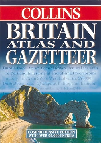
This gazetteer is the most comprehensive available for Great Britain and includes over 55,000 entries complete with description, type of feature and National Grid Reference. Entries include both human features, such as settlments, and physical features, such as mountains and rivers. It is an essential tool for anyone with an interest in places whether for business or pleasure.
There is also an extensive full colour map section for use with the gazetteer listing which features road mapping at a scale of 4.15 miles to 1 inch. In addition to this there are maps showing all the latest administrative area boundaries at approximately 20 miles to 1 inch and London maps at 1 mile to 1 inch.
The gazetteer shows population figures from the latest census for major settlements and administrative areas.
To make the best use of this product please refer to the introduction on page iii.
Also available from Collins:
'Postcode Atlas of Great Britain and Northern Ireland
Postcode Area and District Map of Great Britain
Planner’s Counties, Unitary Authorities and Districts Map of the British Isles
Scotland Atlas and Gazetteer
Collins Road Atlas Britain and Ireland
'
"About this title" may belong to another edition of this title.
- PublisherCollins
- Publication date1999
- ISBN 10 0004487907
- ISBN 13 9780004487908
- BindingHardcover
- Number of pages520
Top Search Results from the AbeBooks Marketplace

Stock Image
Britain Atlas and Gazetteer
Published by
HarperCollins Publishers Limited
(1999)
ISBN 10: 0004487907
ISBN 13: 9780004487908
Used
Hardcover
Quantity: 1
Seller:
Rating
Book Description Condition: Good. Ships from the UK. Used book that is in clean, average condition without any missing pages. Seller Inventory # 38614664-20
Buy Used
� 3.99
Convert currency
Seller Image
Britain Atlas and Gazetteer
Seller:
Rating
Book Description Condition: Good. Most items will be dispatched the same or the next working day. Ex library copy with usual stamps & stickers. Seller Inventory # wbs7765110976
Buy Used
� 5.05
Convert currency
Stock Image
Britain Atlas and Gazetteer
Seller:
Rating
Book Description Hardback. Condition: Very Good. The book has been read, but is in excellent condition. Pages are intact and not marred by notes or highlighting. The spine remains undamaged. Seller Inventory # GOR002920697
Buy Used
� 8.46
Convert currency
Stock Image
Britain Atlas and Gazetteer
Seller:
Rating
Book Description Hardcover. Condition: Very Good. No Jacket. Former library book; May have limited writing in cover pages. Pages are unmarked. ~ ThriftBooks: Read More, Spend Less 3.51. Seller Inventory # G0004487907I4N10
Buy Used
� 13.41
Convert currency
Stock Image
Britain Atlas and Gazetteer: Comprehensive Edition
Seller:
Rating
Book Description Hardcover. Condition: Used; Good. ***Simply Brit*** Welcome to our online used book store, where affordability meets great quality. Dive into a world of captivating reads without breaking the bank. We take pride in offering a wide selection of used books, from classics to hidden gems, ensuring there is something for every literary palate. All orders are shipped within 24 hours and our lightning fast-delivery within 48 hours coupled with our prompt customer service ensures a smooth journey from ordering to delivery. Discover the joy of reading with us, your trusted source for affordable books that do not compromise on quality. Seller Inventory # 3079817
Buy Used
� 3.68
Convert currency
Stock Image
Britain Atlas and Gazetteer
Seller:
Rating
Book Description Condition: Good. Your purchase helps support Sri Lankan Children's Charity 'The Rainbow Centre'. Ex-library, so some stamps and wear, and may have sticker on cover, but in good overall condition. Our donations to The Rainbow Centre have helped provide an education and a safe haven to hundreds of children who live in appalling conditions. Seller Inventory # Z1-L-020-01173
Buy Used
� 6
Convert currency
Stock Image
Collins Britain Atlas and Gazetteer
Published by
Harper Collins Publishers Limited
(1999)
ISBN 10: 0004487907
ISBN 13: 9780004487908
Used
Hardcover
Quantity: 1
Seller:
Rating
Book Description Laminated Hard Boards. Condition: Near Fine. Dust Jacket Condition: Near Fine. 512pp. A super copy of this scarce book. Originally published in 1977, this has been updated, re compilated and re-designed and published in 1999. Illustrated with 119pp of maps, followed by a complete gazetteer. Cloth page divider attached to the head of the spine. Fresh and clean. Dust wrapper not price clipped with minimal shelf wear. A near fine copy. Seller Inventory # 216766
Buy Used
� 81
Convert currency