Ports and Airports: 100 Amazing Views - Hardcover
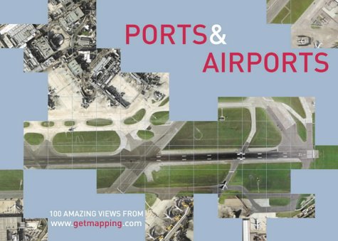

PORTS & AIRPORTS is a compilation of 100 vertical aerial photographs of British docks and airports, taken from the Millennium Map.
Heathrow, the world's busiest passenger airport; St Mary's on the Scilly Isles, perhaps Britain's most exotic holiday destination; Duxford in Cambridgeshire, site of the RAF museum; St Ives, popular Cornish cultural centre and working fishing village; Dover, white cliffs and ferries to France; Skegness, Lincolnshire's famously bracing resort; Wells-next-the-Sea in Norfolk, no longer quite next to the sea due to shifting sands; Milford Haven, Pembrokeshire container port; Stranraer, Ayrshire gateway to Northern Ireland... PORTS & AIRPORTS brings a surprising new angle to places such as these, and many more.
ABOUT THE MILLENNIUM MAP
Still being created, the Millennium Map is a fascinating venture. Inspired by the Domesday Book, Tristram Cary and Joe Studholme of Getmapping.com commissioned four specially equipped aircraft to fly the length and breadth of the country in strips – rather like a lawnmower – each one carrying state-of-the-art camera equipment valued at �250,000. These planes are systematically taking vertical photographs of the whole of the United Kingdom from an average height of 5,500 feet, recording every object right down to a minimum size of 25cm.
So far over 30km of nine-inch-wide film has been taken. After processing, each photograph is scanned at high resolution, subsequently undergoing a process known as geo-correction, which removes distortions caused by the tilt of the aircraft and the contours of the ground; the individual files are then colour-balanced and spliced together to form a single map-accurate 'mosaic' of the entire country.
In what must be the ultimate endorsement of its national significance, Her Majesty the Queen is a private investor in The Millennium Map; and when completed, the map will provide a snapshot of life in the year 2000 as historically important as William the Conqueror's survey of 1086.
"synopsis" may belong to another edition of this title.
From the Back Cover:
Synopsis:
Heathrow, the world's busiest passenger airport; St Mary's on the Scilly Isles, perhaps Britain's most exotic holiday destination; Duxford in Cambridgeshire, site of the RAF museum; St Ives, popular Cornish cultural centre and working fishing village; Dover, white cliffs and ferries to France; Skegness, Lincolnshire's famously bracing resort; Wells-next-the-Sea in Norfolk, no longer quite next to the sea due to shifting sands; Milford Haven, Pembrokeshire container port; Stranraer, Ayrshire gateway to Northern Ireland... PORTS & AIRPORTS brings a surprising new angle to places such as these, and many more.
ABOUT THE MILLENNIUM MAP
Still being created, the Millennium Map is a fascinating venture. Inspired by the Domesday Book, Tristram Cary and Joe Studholme of Getmapping.com commissioned four specially equipped aircraft to fly the length and breadth of the country in strips – rather like a lawnmower – each one carrying state-of-the-art camera equipment valued at �250,000. These planes are systematically taking vertical photographs of the whole of the United Kingdom from an average height of 5,500 feet, recording every object right down to a minimum size of 25cm.
So far over 30km of nine-inch-wide film has been taken. After processing, each photograph is scanned at high resolution, subsequently undergoing a process known as geo-correction, which removes distortions caused by the tilt of the aircraft and the contours of the ground; the individual files are then colour-balanced and spliced together to form a single map-accurate 'mosaic' of the entire country.
In what must be the ultimate endorsement of its national significance, Her Majesty the Queen is a private investor in The Millennium Map; and when completed, the map will provide a snapshot of life in the year 2000 as historically important as William the Conqueror's survey of 1086.
"Ports and Airports" is a compilation of 100 vertical aerial photographs of British docks and airports, taken from the "Millennium Map". The "Millennium Map" consists of vertical photographs of the whole of the United Kingdom from an average height of 5500 feet, recording every object right down to a minimum size of 25cm. Heathrow, the world's busiest passenger airport; St Mary's on the Scilly Isles, perhaps Britain's most exotic holiday destination; Duxford in Cambridgeshire, site of the RAF museum; St Ives, popular Cornish cultural centre and working fishing village; Dover, white cliffs and ferries to France; Skegness, Lincolnshire's famously bracing resort; Wells-next-the-Sea in Norfolk, no longer quite next to the sea due to shifting sands; Milford Haven, Pembrokeshire container port; Stranraer, Ayrshire gateway to Northern Ireland - this volume should bring a surprising new angle to places such as these.
"About this title" may belong to another edition of this title.
- PublisherCollins
- Publication date2002
- ISBN 10 0007122799
- ISBN 13 9780007122790
- BindingHardcover
- Number of pages128
Buy New
Learn more about this copy
� 13.50
Shipping:
� 30
From United Kingdom to U.S.A.
Top Search Results from the AbeBooks Marketplace
Stock Image
PORTS AND AIRPORTS: 100 Amazing Views from Getmapping
Published by
HarperCollins, London
(2002)
ISBN 10: 0007122799
ISBN 13: 9780007122790
New
Hardcover
First Edition
Quantity: 1
Seller:
Rating
Book Description Hard Cover. Condition: New. First Edition. 100 of Britain's busiest commercial docks, picturesque harbours, international airports and military airbases are featured here, using Getmapping's high quality colour aerial photography. 128 pages. Laminated Pictorial Boards. Every book is sent in a rigid cardboard posting box. Size: 15.5cm x 21.5 Cm. Seller Inventory # 1673
Buy New
� 13.50
Convert currency