Illustrated Edinburgh Map - Softcover
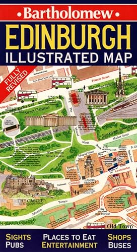

Delightful water-colour mapping with large-scale plans of the Castle, Royal Mile, Botanic Gardens, shopping and entertainment areas. Individual paintings of all the main sights and landmarks.
Includes:
Comprehensive index.
Railway stations, bus routes, taxi ranks and car parks.
Historical and contemporary anecdotes.
Day trips.
Shop by shop street maps.
OTHER TITLES IN THE SERIES
Illustrated Dublin Map
Illustrated London Map
"synopsis" may belong to another edition of this title.
Synopsis:
A fold-out map of Edinburgh, containing large-scale plans of the Castle, Royal Mile, Botanic Gardens, shopping and entertainment areas. Also included are individual paintings of all the main sights and landmarks, historical and contemporary anecdotes, and information on day trips.
From the Back Cover:
Highly original maps featuring all the major sights and places of interest depicted by delightful watercolour illustrations. A wealth of local information in easy to use formats.
"About this title" may belong to another edition of this title.
- PublisherCollins
- Publication date1998
- ISBN 10 0004487680
- ISBN 13 9780004487687
- BindingPaperback
- Rating
Top Search Results from the AbeBooks Marketplace

Stock Image
Illustrated Edinburgh Map (Collins British Isles and Ireland Maps)
Seller:
Rating
Book Description Map. Condition: Very Good. Illustrated Edinburgh Map (Collins British Isles and Ireland Maps) This book is in very good condition and will be shipped within 24 hours of ordering. The cover may have some limited signs of wear but the pages are clean, intact and the spine remains undamaged. This book has clearly been well maintained and looked after thus far. Money back guarantee if you are not satisfied. See all our books here, order more than 1 book and get discounted shipping. Seller Inventory # 7719-9780004487687
Buy Used
� 3.54
Convert currency
Stock Image
Illustrated Edinburgh Map (Collins British Isles and Ireland Maps)
Seller:
Rating
Book Description Map. Condition: Very Good. This book is in very good condition and will be shipped within 24 hours of ordering. The cover may have some limited signs of wear but the pages are clean, intact and the spine remains undamaged. This book has clearly been well maintained and looked after thus far. Money back guarantee if you are not satisfied. See all our books here, order more than 1 book and get discounted shipping. Seller Inventory # 6545-9780004487687
Buy Used
� 3.54
Convert currency
Stock Image
Illustrated Edinburgh Map
Seller:
Rating
Book Description Paperback. Condition: Good. NOT ex-library. Clean copy in good condition. Quick dispatch from UK seller. Seller Inventory # mon0000111382
Buy Used
� 0.81
Convert currency